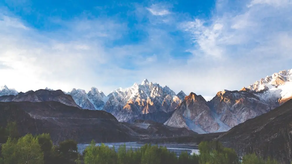
The world’s most challenging hikes test every aspect of human endurance, skill, and mental fortitude. From oxygen-starved peaks above 20,000 feet to treacherous cliff-side paths where one wrong step means death, these trails separate the casual hikers from the truly elite adventurers. This comprehensive guide examines the 15 hardest hikes in the world, analyzing what makes each route so formidable and providing insights for those brave enough to attempt them.
- 1. Mount Huashan Plank Walk, China
- The Challenge
- Critical Facts
- 2. GR20, Corsica, France
- The Challenge
- Critical Facts
- Technical Sections
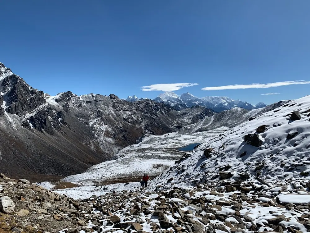
- 3. The Snowman Trek, Bhutan
- The Challenge
- Critical Facts
- Unique Hazards
- 4. K2 Base Camp Trek, Pakistan
- Critical Facts
- Survival Insights
- 5. Annapurna Circuit, Nepal
- Critical Facts
- Technical Details
- 6. Torres del Paine “O” Circuit, Chile
- The Challenge
- Critical Facts
- Weather Survival
- 7. Kalalau Trail, Hawaii, USA
- Critical Facts
- Unique Hazards
- 8. Everest Base Camp Trek, Nepal
- The Challenge
- Critical Facts
- Altitude Physiology
- 9. Kokoda Track, Papua New Guinea
- Dangers Along the Kokoda Track
- 10. Makalu Base Camp Trek, Nepal
- Dangers of Makalu Base Camp Trek
- 11. Mount McKinley Cassin Ridge, Alaska
- The Challenge
- Critical Facts
- Technical Sections
- 12. The Maze, Canyonlands National Park, Utah
- The Challenge
- Critical Facts
- Route-Finding Challenges
- 13. Haute Route, France/Switzerland
- The Challenge
- Critical Facts
- Alpine Hazards
- 14. Laugavegur Trail, Iceland
- The Challenge
- Critical Facts
- Geothermal Dangers
- 15. Mount Katahdin – Knife Edge, Maine
- The Challenge
- Critical Facts
- Ridge Walking Technique
- Read more
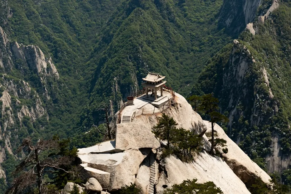
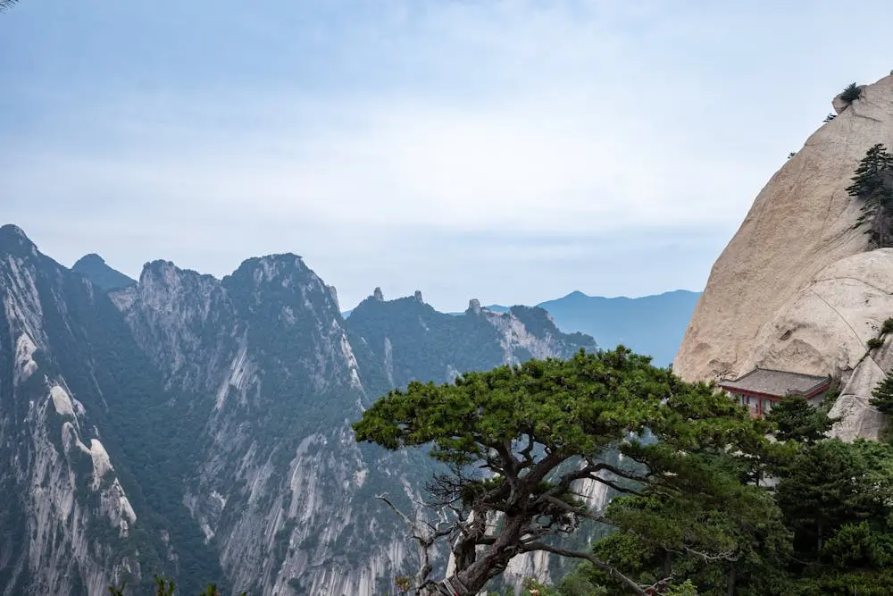
1. Mount Huashan Plank Walk, China
Mount Hua (Huashan) in China earns its fearsome reputation not through length or altitude, but sheer terror factor. Often billed as the “world’s most dangerous hike”, Huashan’s infamous plank walk has become a viral legend.
The Challenge
Located in Shaanxi Province, this ancient Taoist pilgrimage route features a harrowing section where hikers must traverse a narrow wooden plank bolted to a vertical cliff face 7,000 feet above the valley floor.
The mountain, being one of China’s sacred Taoist peaks, soars to 2,154 m and is laced with nearly vertical stone stairways and dizzying precipices. The traditional ascent (“Thousands-Foot Staircase”) is a near-vertical staircase chiselled into rock, with only chains to hold.
The plank walk itself is only about 100 feet long, but it’s preceded by miles of treacherous climbing on steep stone steps, many of which were carved directly into the rock face over 700 years ago.
To reach the summit, hikers need to scale uneven steps and a series of ladders before hooking themselves onto a chain to traverse its renowned “plank walk.” The entire route to the South Peak covers approximately 12 kilometers with an elevation gain of 1,800 meters.
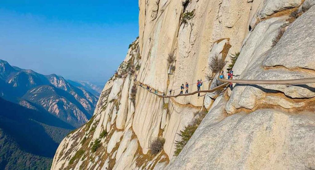
With nothing but 600 m of air below your feet, it’s a heart-pounding experience that has inspired countless online videos (and a fair share of nightmares).
While the safety harnesses make it more secure than legend suggests, the adrenaline rush is very real, especially when you have to step around oncoming hikers on the same plank.
Critical Facts
- Death toll: While exact numbers are disputed, estimates suggest dozens of fatalities annually
- Weather hazards: Sudden fog can reduce visibility to zero on exposed sections
- Equipment required: Safety harnesses are mandatory for the plank walk section
- Best season: April through October, avoiding winter ice conditions
- Average completion time: 8-12 hours for the full circuit
Today, thousands of tourists take on Huashan annually (many via cable car partway), but it remains not for the faint of heart.
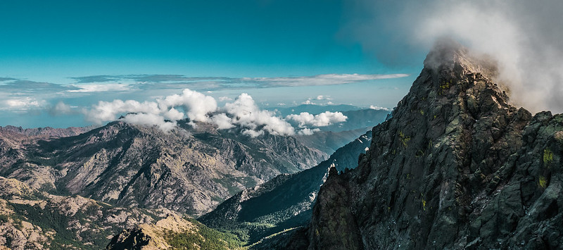
2. GR20, Corsica, France
France’s GR20 traverses the length of Corsica and is widely considered one of the toughest hikes in the world. Despite being “only” 180 kilometers, the trail’s relentless difficulty and technical sections make it a formidable challenge that defeats many experienced hikers.
The Challenge
The GR20 crosses Corsica’s mountainous spine, featuring constant elevation changes totaling over 12,000 meters of ascent and descent. The trail includes extensive scrambling sections, some requiring Class 3 climbing skills, and passes through terrain so rugged that alternative routes often don’t exist.
Trek Details
Thunderstorms can sweep in suddenly, turning rocks slippery and streams into torrents. The reward? Some of the most spectacular scenery in Europe: emerald mountain lakes, spiky peaks like Monte Cinto (the island’s highest), and sweeping valleys dotted with wildflowers.
Critical Facts
- Completion rate: Approximately 50% of hikers finish the entire route
- Technical grade: Some sections rated Class 3-4 scrambling
- Average completion time: 15 days for experienced hikers
- Objective hazards: Lightning storms, loose rock, flash floods
- Rescue statistics: 50-100 rescue operations annually
Technical Sections
The Cirque de la Solitude is the route’s most feared section, requiring technical scrambling and chain assistance. Recent rockfall has made this area even more dangerous. The Bavella Needles section involves exposed ridge walking where a fall could be fatal.
3. The Snowman Trek, Bhutan
Bhutan’s Snowman Trek is arguably the most difficult trek in the Himalayas, combining extreme remoteness with technical challenges. This 25-day odyssey through the Bhutanese Himalayas crosses eleven high-altitude passes, including the 5,320-meter Rinchen Zoe La.

The Challenge
The trek covers approximately 350 kilometers through some of the world’s most pristine wilderness, and is considered one of the highest hikes in the world. Weather conditions are notoriously unpredictable, with success rates below 40% due to impassable conditions. The route includes extended periods above 4,000 meters, testing trekkers’ acclimatization limits.
Trek Details
Critical Facts
- Success rate: 35-40% completion rate
- Permit cost: $200+ per day, tourist tax plus trek permits
- Group requirements: Must be arranged through licensed operators
- Evacuation difficulties: Some sections require 3-4 days to reach medical facilities
- Best weather window: September-October only
Unique Hazards
The Snowman Trek faces unique challenges, including yak attacks (the route passes through herding areas), river crossings with no bridges, and camping on glacial moraines. The Table Mountain crossing requires basic mountaineering skills, and several sections involve route-finding across unmarked terrain.
4. K2 Base Camp Trek, Pakistan
The journey to K2 Base Camp in Pakistan’s Karakoram is often considered the ultimate high-altitude trek for hardened hikers. It’s a 2-week expedition (around 120 km round-trip) through the rugged Baltoro Glacier to reach Concordia, the famed junction of glaciers ringed by towering peaks, and then onward to K2 Base Camp (~5,100 m).
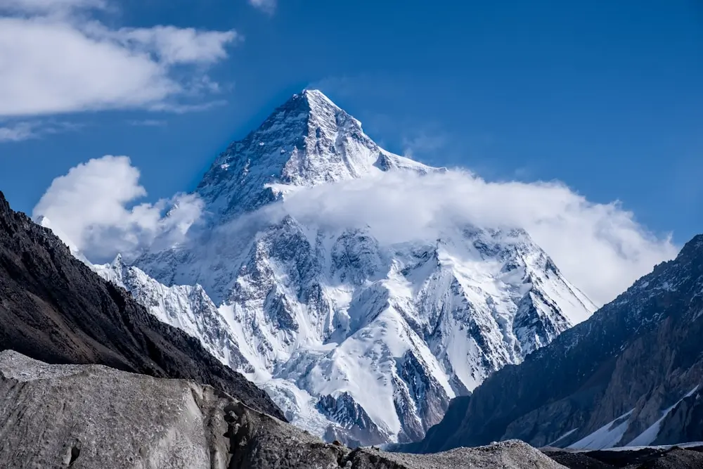
This trek has no villages or lodges beyond the trailhead; from day one, you are in a world of ice, rock, and sky. You’ll be camping on glaciers each night, surrounded by 7,000 and 8,000-meter giants like K2, Broad Peak, and the Gasherbrums.
K2 is considered the hardest mountain due to its steep, technical ascents and unforgiving terrain. While the base camp trek doesn’t involve actual mountaineering, it demands exceptional physical fitness and mental resilience.
Overall, we’d say that the K2 Base Camp trek is more challenging than the trek to Everest Base Camp. The route includes the infamous Baltoro Glacier, a 62-kilometer river of ice and rock that must be navigated with extreme caution.
The Karakoram weather is notoriously fickle; clear mornings can turn into sudden afternoon snowstorms even in summer. At least a couple of times each season, groups get pinned down by heavy snow or storms that delay progress.
Critical Facts
- Maximum elevation: 5,150 meters (16,896 feet) at Concordia
- Objective hazards: Avalanches, crevasses, rockfall, and extreme weather
- Success rate: Approximately 60% of trekkers complete the full circuit
- Emergency evacuation: Helicopter rescue impossible above 4,500 meters
- Required fitness level: Ability to hike 8-10 hours daily carrying a 15-20kg pack
Survival Insights
Success on the K2 Base Camp trek depends heavily on acclimatization strategy. The route includes built-in rest days at Concordia and Goro II, but many trekkers still suffer from severe altitude sickness. Carry comprehensive first aid supplies and understand the symptoms of High Altitude Pulmonary Edema (HAPE) and High Altitude Cerebral Edema (HACE).
5. Annapurna Circuit, Nepal
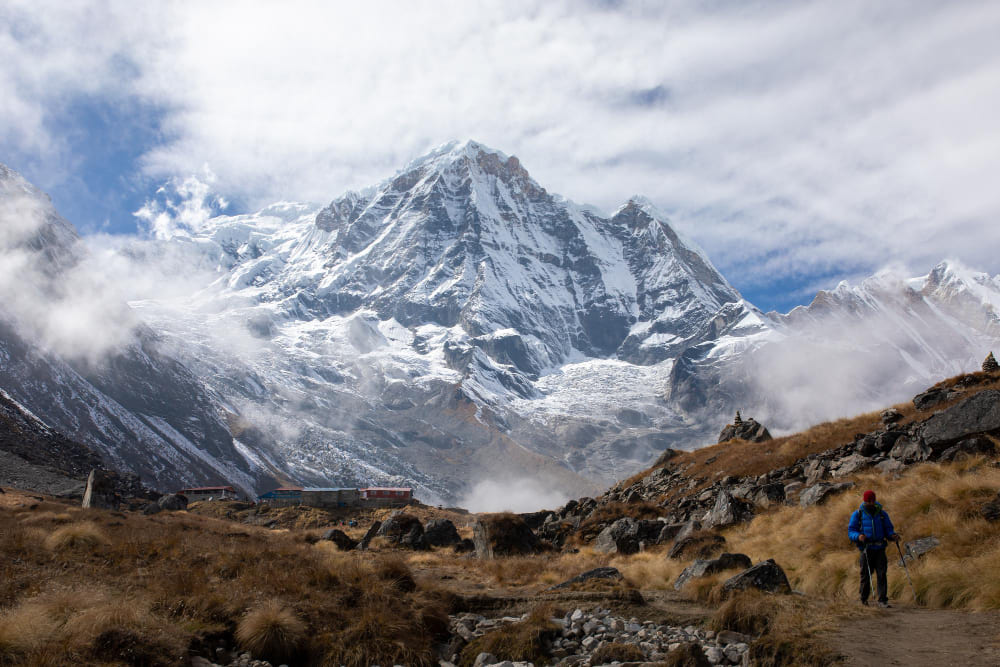
The Annapurna Circuit is a classic 2–3 week trek that circles Nepal’s Annapurna Massif, crossing the Thorong La Pass (5,416 m) at its high point.
It’s often hailed as one of the best hiking trails worldwide, and also one of the toughest. The trail covers around 160–230 km, depending on the route, with a huge total elevation gain.
The traditional circuit spans 230 kilometers and takes 15-20 days to complete. Trekkers must navigate dramatic altitude changes, from subtropical lowlands at 800 meters to alpine conditions above 5,000 meters. The route’s difficulty has increased in recent years due to climate change affecting traditional rest stops and water sources.
Critical Facts
- Total elevation gain: Over 10,000 meters cumulative
- Objective hazards: Avalanche risk at Thorong La, sudden weather changes
- Permit requirements: ACAP and TIMS permits are mandatory
- Rescue facilities: Limited helicopter access due to altitude and weather
- Annual fatalities: 2-5 deaths per year, mostly from altitude-related illness
Technical Details
The Thorong La crossing is the crux of the circuit. At 5,416 meters, it’s higher than Mount Whitney, and weather windows can close rapidly. Many trekkers attempt the crossing too quickly, leading to altitude sickness. The descent to Muktinath is treacherous when icy, with loose scree creating additional hazards.
Trek Details
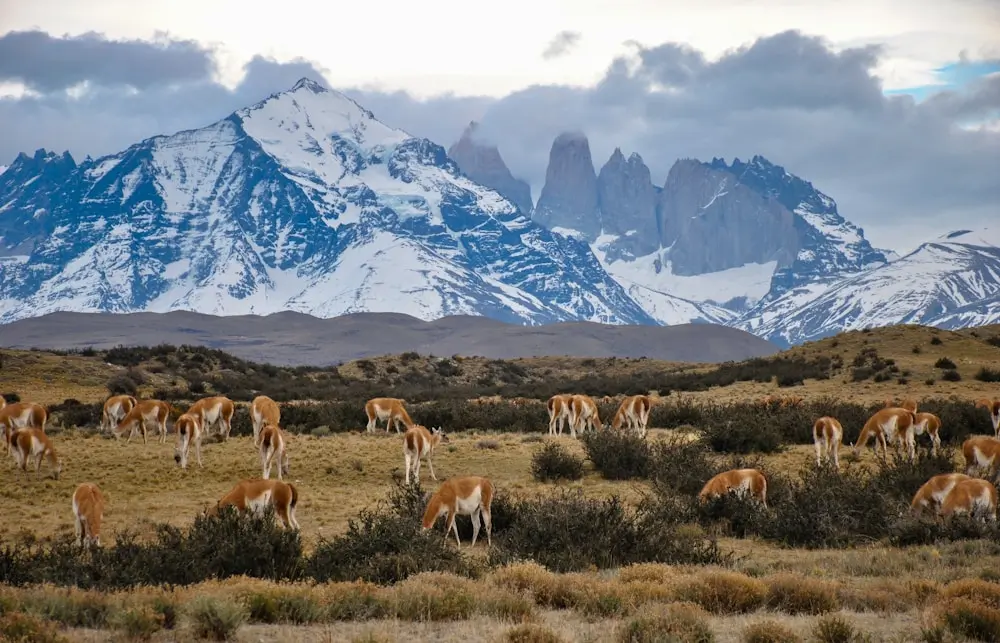
6. Torres del Paine “O” Circuit, Chile
Patagonia’s complete Torres del Paine circuit combines the famous “W” trek with the remote backside of the massif, creating a demanding 130-kilometer loop through some of the world’s most volatile weather conditions.
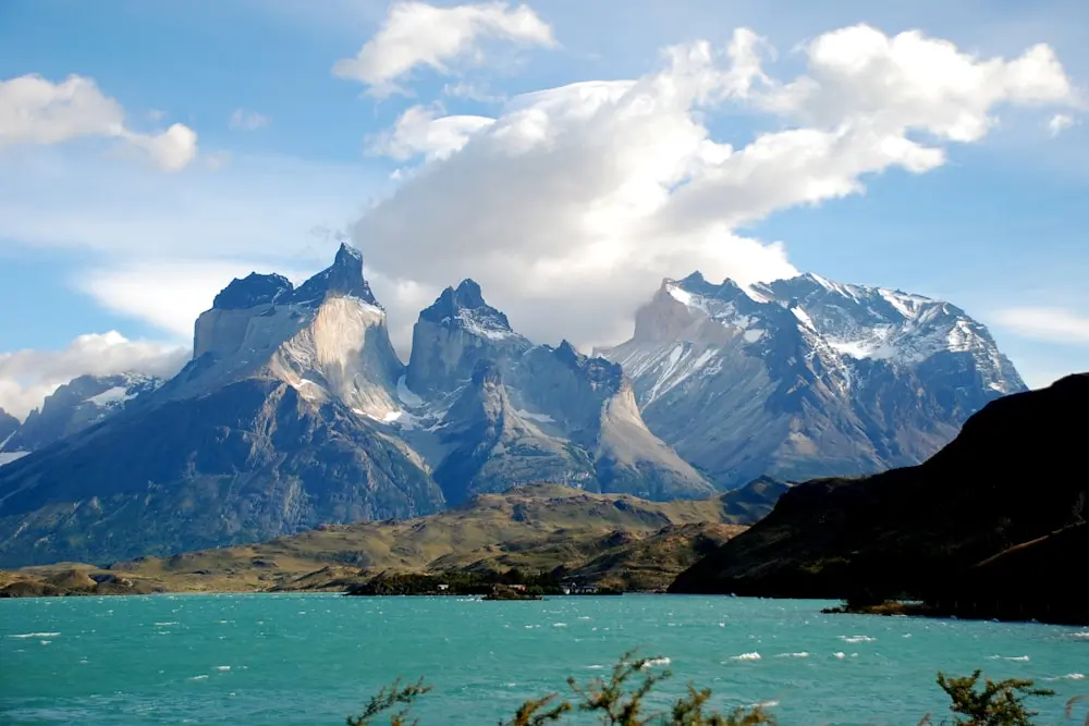
The Challenge
The “O” circuit faces Patagonia’s notorious weather, where 150 km/h winds are common and weather can change from sunshine to blizzard in minutes. The remote northern section lacks refugios, requiring complete self-sufficiency for 3-4 days. River crossings can become impassable during storms.
Critical Facts
- Wind speeds: Regularly exceed 100 km/h, with gusts over 200 km/h recorded
- Weather variability: Four seasons are possible in a single day
- River crossings: No bridges on several major crossings
- Wildlife hazards: Puma encounters are increasingly common
- Permit system: Limited camping spots require booking
Weather Survival
Patagonian weather is the circuit’s primary challenge. Katabatic winds can literally blow hikers off their feet, and hypothermia risk exists even in summer. The John Gardner Pass is particularly dangerous, with several fatalities from falls during high winds.
7. Kalalau Trail, Hawaii, USA
The Kalalau Trail snakes along Kauai’s Nā Pali Coast, often cited as one of the world’s most beautiful and dangerous hikes. Though it doesn’t reach extreme altitude (the trail undulates from sea level to a high point of a few hundred meters), Kalalau compensates with treacherous terrain and exposure.
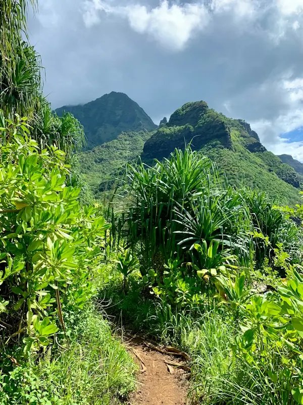
This 35 km (22 mi) round-trip journey hugs sheer volcanic cliffs above the Pacific, where one false step could send you tumbling into the crashing surf. The path is narrow, steep, and rocky, with sections like “Crawler’s Ledge” that are just a couple of feet wide on a vertical cliff face.
Critical Facts
- Annual fatalities: 2-4 deaths per year, mostly from falls
- Flash flood risk: 15+ stream crossings become impassable during rain
- Permit requirements: Camping permits are required for overnight trips
- Emergency access: Helicopter evacuation is often impossible due to weather
- Trail conditions: Frequently closed due to washouts and landslides
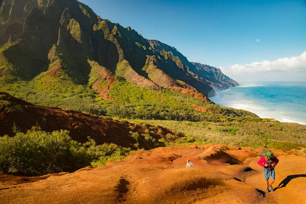
Unique Hazards
The Kalalau Trail faces unique tropical hazards, including centipede and spider bites, leptospirosis from contaminated water, and the risk of being stranded by flash floods. The trail’s popularity creates additional dangers as inexperienced hikers attempt the route without proper preparation.
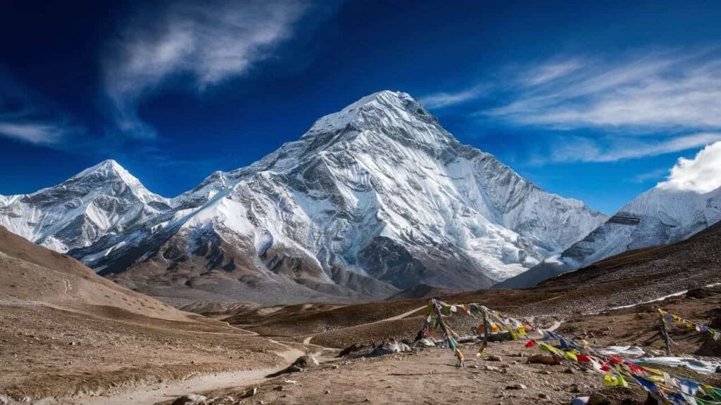
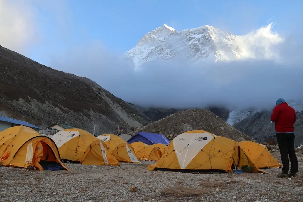
8. Everest Base Camp Trek, Nepal
While not technically difficult, the Everest Base Camp trek challenges hikers with extreme altitude, unpredictable weather, and the risks associated with the world’s most famous mountain. The route to EBC at 5,364 meters tests altitude acclimatization more than most peaks, twice the difficulty.
The Challenge
The 130-kilometer trek gains over 2,700 meters in elevation, with the final approach to base camp crossing the treacherous Khumbu Glacier. Altitude sickness affects 80% of trekkers, and the “death zone” begins just 3,000 feet above the trail’s highest point.
Critical Facts
- Altitude sickness rate: 80% experience symptoms above 4,000m
- Annual fatalities: 2-3 deaths per year on the trek itself
- Helicopter rescues: 50+ per year, costing $5,000-15,000 each
- Weather windows: Only two safe seasons (March-May, September-November)
- Khumbu Icefall proximity: Base camp sits below one of the world’s most dangerous features
Altitude Physiology
Above 3,500 meters, the human body cannot fully acclimatize, beginning a race against physiological deterioration. The EBC trek’s rapid elevation gain doesn’t allow proper acclimatization, making altitude-related emergencies common. HAPE and HACE can develop rapidly above 4,000 meters.
9. Kokoda Track, Papua New Guinea
Winding through the steaming jungles of Papua New Guinea, the Kokoda Track is a trek where history and physical hardship go hand in hand. This 96 km trail cuts across the Owen Stanley Range, a formidable mountain chain cloaked in dense rainforest.
Kokoda is legendary as the site of a fierce WWII campaign in 1942, when Australian and Japanese forces battled along this very track.
Today’s trekkers contend with many of the same obstacles that those soldiers faced: intense heat and humidity, knee-deep mud, torrential rains, and terrain that alternates between steep inclines and equally steep declines.
The track’s highest point is around 2,190 m at Mount Bellamy, but you’ll cumulatively climb far more due to endless ridges and valleys. Trails turn to slick mud; every descent is a quad-burning, balance-testing slide, and every climb a sweaty slog grabbing at tree roots for support.
Dangers Along the Kokoda Track
River crossings are frequent (sometimes over improvised log bridges, sometimes wading). Leeches, malaria-carrying mosquitoes, and prickly jungle plants are constant companions. The trail is largely unmaintained, steep, muddy, and slippery, cutting through dense jungle and over mountains.
10. Makalu Base Camp Trek, Nepal
The Makalu Base Camp trek takes you to the foot of Mount Makalu (8,485 m), the world’s fifth highest mountain, through Nepal’s far eastern ranges. This trek is lesser-known but extremely challenging; it has a reputation as one of the most difficult teahouse treks in Nepal, due to its isolation, tough terrain, and high altitude.
The route spans roughly 18–20 days round-trip, beginning in the deep subtropical Arun Valley and ascending to Makalu Base Camp at ~4,870 m.
The trail is an emotional rollercoaster of endless uphill and downhill sections on steep valley sides, and it tops out on one of the highest trekking camps in Nepal.
Dangers of Makalu Base Camp Trek
Makalu’s challenges are remoteness and ruggedness. The trail includes sections through dense forests and along narrow cliffside paths where a misstep could be dangerous.
There are also notorious landslide areas that must be crossed carefully (especially after the monsoon, when trails can be washed out or covered in debris). Altitude acclimatization is tricky as the trek involves rapid ascent from around 800 m at Tumlingtar to over 4,000 m within a week or so.
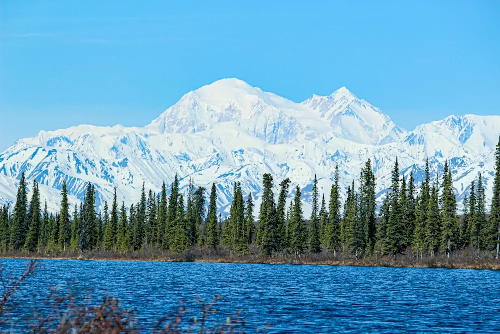
11. Mount McKinley Cassin Ridge, Alaska
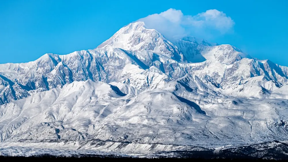
The Cassin Ridge represents one of the most technical and committing routes in North America. This Grade V route on Denali’s south face requires advanced rock and ice climbing skills combined with high-altitude mountaineering experience.
The Challenge
The 9,000-foot route involves sustained technical climbing at altitude, with sections of WI4 ice and 5.6 rock climbing while carrying full expedition loads. The route typically requires 7-10 days on the face with no retreat options once committed above the Japanese Couloir.
Critical Facts
- Technical grade: Alaska Grade 5, WI4, 5.6 rock
- Commitment level: 3-4 days minimum to reach safe descent
- Success rate: Less than 30% due to weather and technical difficulty
- Rescue impossibility: No helicopter access to the route
- Annual attempts: Fewer than 50 parties attempt the route yearly
Technical Sections
The route’s crux involves the Cassin Ledges, a series of mixed climbing pitches at 16,000+ feet where technical difficulty peaks just as oxygen levels become critical. The Japanese Couloir exit requires navigating through a serac field that has collapsed several times, crushing camps below.
12. The Maze, Canyonlands National Park, Utah
There’s a reason this hike is called The Maze: it’s quite literally a labyrinth of red rock and dead-end canyons that takes expert planning and self-sufficiency to tackle. This remote section of Canyonlands requires advanced navigation skills and complete self-reliance.
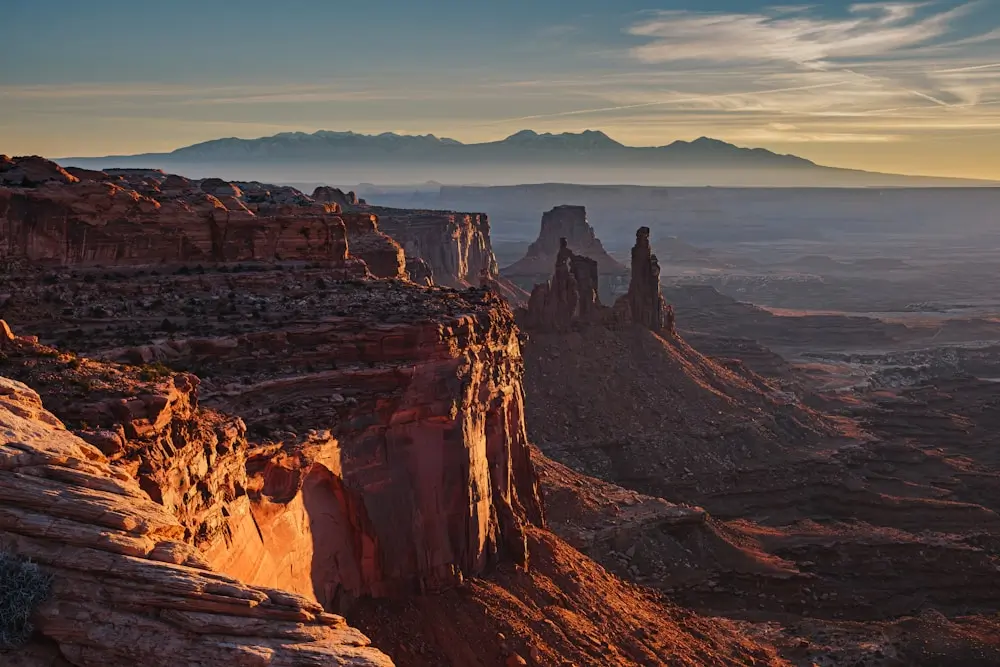
The Challenge
The Maze district covers 30 square miles of convoluted canyons where getting lost can be fatal. No marked trails exist, and GPS units frequently lose signal in the deep canyons. The approach requires 4WD vehicles and expert driving skills to reach trailheads.
Critical Facts
- Visitor numbers: Fewer than 1,000 people per year attempt access
- Water sources: Extremely limited, requiring 1+ gallon per person per day
- Rescue difficulty: Multi-day evacuations common
- Navigation grade: Expert route-finding skills mandatory
- Emergency communication: Cell service non-existent
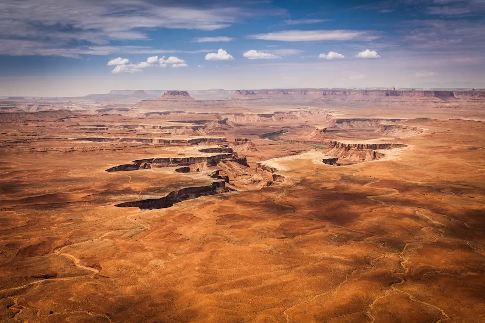
Route-Finding Challenges
The Maze requires topographic map and compass navigation skills that most modern hikers lack. Cairns exist but are often misleading or destroyed by flash floods. The complex canyon system can trap hikers for days, and several people have died from exposure after becoming lost.
13. Haute Route, France/Switzerland
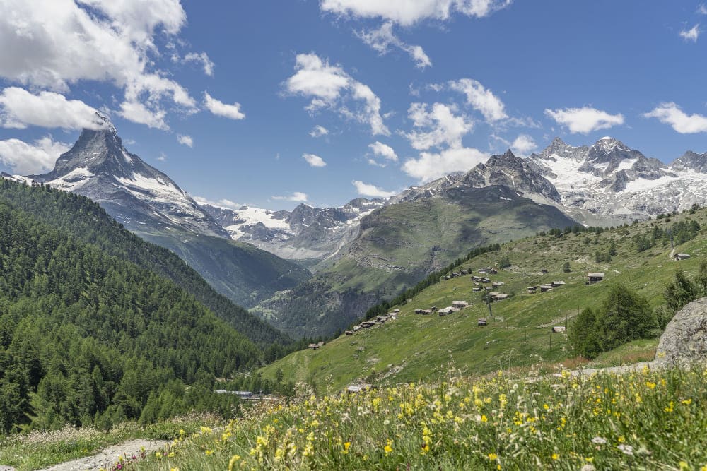
The Walker’s Haute Route between Chamonix and Zermatt is considered the world’s premier high-altitude trek, crossing eleven mountain passes above 2,500 meters. The route demands exceptional fitness and alpine experience.
The Challenge
The 180-kilometer route involves nearly 15,000 meters of cumulative elevation gain while crossing some of the Alps’ most technical terrain. Several sections require glacier travel and basic mountaineering skills. Weather changes rapidly, and rescue operations are complicated by international borders.
Critical Facts
- Technical sections: Glacier crossings require ropes and crampons
- Altitude challenges: Multiple passes above 3,000 meters
- Weather dependency: 50% success rate due to conditions
- Rescue coordination: Complex due to France/Switzerland border crossings
- Fitness requirements: Comparable to moderate mountaineering expeditions
Alpine Hazards
The Haute Route crosses active avalanche zones, crevassed glaciers, and loose rock faces. The Pigne d’Arolla glacier crossing has claimed several lives when hikers attempted it without proper equipment or knowledge of glacier travel techniques.
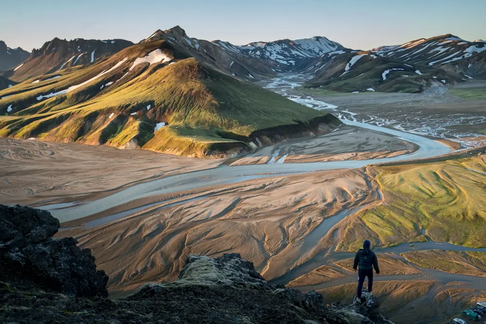
14. Laugavegur Trail, Iceland
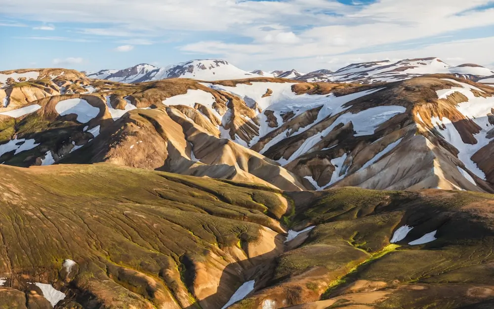
Iceland’s Laugavegur Trail traverses some of Europe’s most active volcanic terrain, where hikers encounter geothermal hazards, extreme weather conditions, and river crossings that can become deadly torrents within hours.
The Challenge
The 55-kilometer trail crosses the Landmannalaugar highlands, featuring river crossings with no bridges, camping near active geothermal areas, and exposure to Arctic weather conditions even in summer. The trail passes through areas of recent volcanic activity where ground temperatures can exceed 100°C.
Critical Facts
- River crossings: 15+ unbridged river crossings, some requiring ropes
- Geothermal hazards: Ground collapse and scalding water risks
- Weather extremes: Snow possible year-round, winds exceed 100 km/h
- Volcanic activity: Trail crosses areas of recent eruptions
- Isolation factor: Days from rescue in some sections
Geothermal Dangers
The trail passes through active geothermal areas where the ground can collapse without warning, exposing hikers to scalding water and steam. Several hikers have suffered severe burns from breaking through seemingly solid ground into hot springs beneath.
15. Mount Katahdin – Knife Edge, Maine
Mount Katahdin’s Knife Edge traverse is considered the most dangerous hiking route on the U.S. East Coast. The mile-long ridge connecting Pamola Peak to Baxter Peak is only 2-3 feet wide with 1,000-foot drops on both sides.
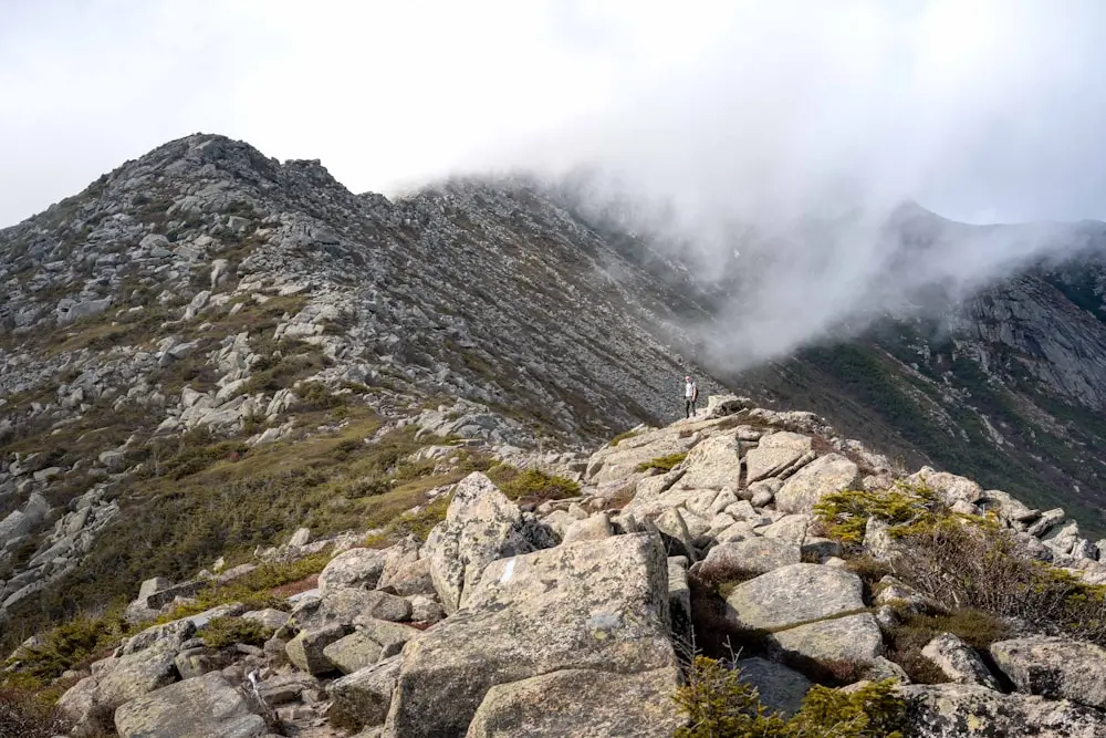
The Challenge
The Knife Edge requires constant attention to foot placement along a narrow granite ridge exposed to Maine’s notorious weather. High winds, sudden storms, and loose rock create conditions where a single mistake can be fatal. The route has no escape points once committed.
Critical Facts
- Fatal accidents: 2-3 deaths per year on the Knife Edge
- Weather closure: Closed when winds exceed 25 mph
- Technical grade: Class 3-4 scrambling with severe exposure
- Commitment level: No escape routes for 1+ mile
- Season limitations: Accessible only June through October
Ridge Walking Technique
Success on the Knife Edge requires understanding exposed ridge techniques typically used in mountaineering. Maintaining three points of contact, understanding wind effects on balance, and recognizing when conditions become too dangerous are crucial skills.
What are the hardest hiking trails in the world?
The hardest are considered K2 and GR20, though the Sky Plank Walk on Mount Hua, even being a short one, is considered hard due to the mental challenge
What is the most difficult trek in the world?
Surprisingly, given that Everest is the tallest and highest mountain, the Everest Base Camp Trek is not one of the hardest; often, K2 Base Camp and the GR20 are considered to be the most difficult.