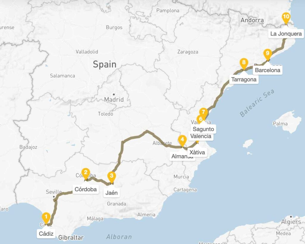
Via Augusta is an ancient Roman road running through Mediterranean Spain, from Gades (Cádiz) to the Pyrenees Mountains. Built during the reign of Augustus (27 BC – 14 AD), the Via Augusta served as the backbone of Roman Hispania.
- Day 1-2: Cádiz (Gades) – Starting Point
- Roman Heritage of Cádiz
- Walking Section
- Day 3-4: Córdoba (Corduba)
- Roman Heritage of Córdoba
- Walking Section
- Day 5: Jaén – Roman Aurgi
- Roman Heritage of Jaén
- Walking Section
- Day 6-7: Valencia Region Entry – Almansa to Xàtiva
- Roman Heritage at Almansa
- Walking Section – Almansa
- Xàtiva (Saetabis)
- Roman Heritage at Xàtiva
- Walking Section – Xàtiva
- Day 8-9: Sagunto (Saguntum) – Major Roman Site
- Roman Heritage
- Walking Section
- Day 10-11: Valencia (Valentia)
- Roman Heritage of Valencia
- Walking Section
- Day 12: Tarragona (Tarraco) – UNESCO World Heritage
- Roman Heritage (UNESCO Site)
- Walking Section
- Day 13-14: Barcelona (Barcino)
- Roman Heritage
- Walking Section
- Day 15: La Jonquera/Coll de Panissars – End Point
- Roman Heritage
- Via Augusta Route Highlights
- Roman Engineering Features along Via Augusta
- Archaeological sites along the way
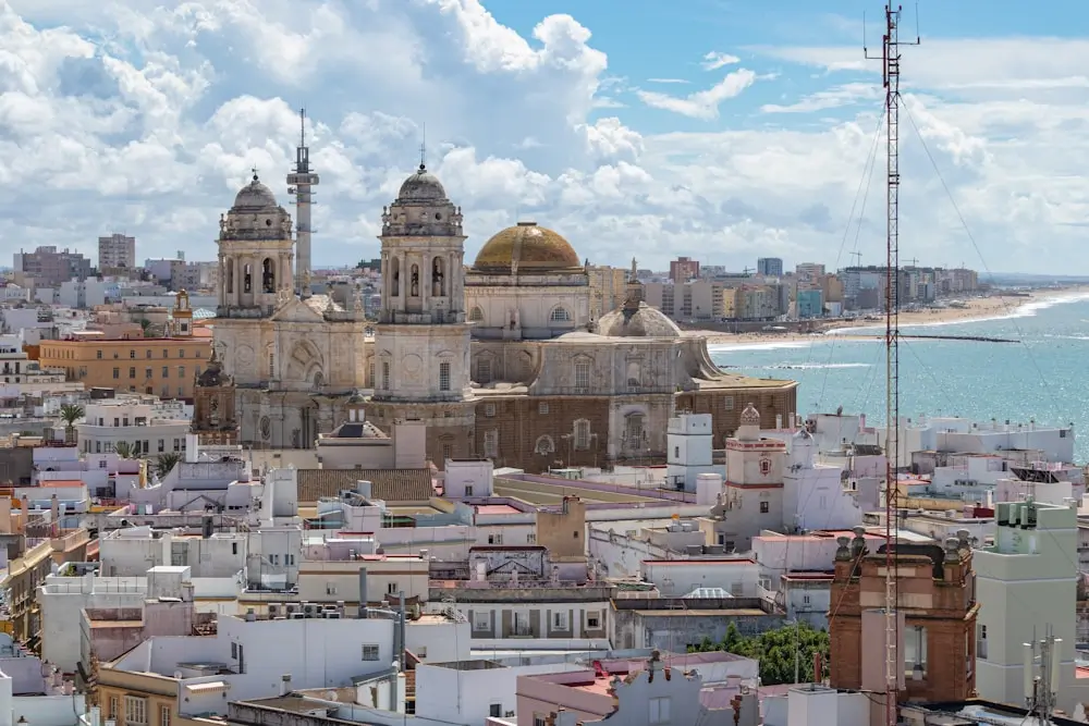
Day 1-2: Cádiz (Gades) – Starting Point
Cádiz, known in Roman times as Gades, was one of the oldest and most important cities in the western empire. Founded by the Phoenicians and later expanded under Roman rule, Gades became a key port for trade with Hispania and North Africa.
By the 1st century BCE, it was a wealthy colony with a Roman forum, temples, and an amphitheater, remnants of which still shape the city’s old quarter. Here you can explore the underlying Roman street grid, view artifacts at the Cádiz Museum, and walk the coastline once lined with Roman salting factories central to the region’s booming fish sauce trade.
Roman Heritage of Cádiz
- Cádiz Archaeological Museum: Roman portrait busts from Baelo Claudia, amphorae collection
- Roman Theatre of Cádiz: 2nd century BC theatre, recently excavated
- Casa del Obispo Archaeological Site: Roman domus with mosaics, hypocaust heating system
- Via Augusta starting point: Walk from Puerta de Tierra to the old harbor, following the ancient route
Walking Section
Start at Puerta de Tierra, walk southeast through Calle Ancha to Plaza San Juan de Dios, continue to the cathedral area where Casa del Obispo shows Roman foundations. The Via Augusta began near the ancient harbor area (current Parque Genovés vicinity).
Distance: 2.5 km, 45 minutes
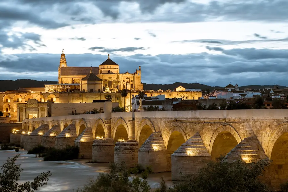
Day 3-4: Córdoba (Corduba)
Distance from Cádiz: 260 km, approximately 3 hours by A-4 highway, even faster by Renfe AVE train.
Córdoba, once Corduba, was the capital of Roman Baetica. Founded in the 2nd century BCE, it grew into a major administrative and cultural center under Augustus.
Corduba produced notable Roman figures, including Seneca the Elder and Younger, and was known for its education, mosaics, and lavish villas.
Roman Heritage of Córdoba
- Roman Bridge (Puente Romano): 16-arch bridge over the Guadalquivir River, Via Augusta crossing point
- Roman Temple: 1st century AD Corinthian temple ruins on Calle Claudio Marcelo
- Archaeological Museum of Córdoba: Roman mosaics from Villa del Cortijo de Chinales, marble statue of Emperor Trajan
- Roman Mausoleum: Cylindrical funerary monument on Avenida de la Victoria
- Alcázar de los Reyes Cristianos: Built on Roman foundations, Roman sarcophagi in gardens
Walking Section
Start at the Roman Bridge south entrance, cross the bridge following the Via Augusta route, walk north through Judería along Calle Torrijos to the Roman Temple site, and continue to Plaza de Jerónimo Páez (Archaeological Museum). End at Alcázar. Distance: 3.2 km, 1 hour 15 minutes
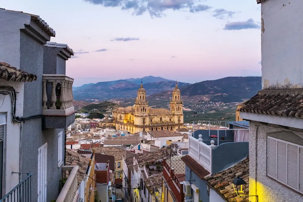
Day 5: Jaén – Roman Aurgi
Distance from Córdoba: 110 km by A-4 and A-316 highways.
Jaén, known to the Romans as Aurgi, served as a strategic inland settlement along the Via Augusta. While less monumental than coastal cities, Aurgi played a vital role in connecting trade routes between Baetica and the interior.
Roman influence is still visible in the city’s layout and in artifacts preserved at the Museo Íbero and the Provincial Museum, including coins, ceramics, and inscriptions. Aurgi was also part of the olive oil trade that defined the region’s economy.
Roman Heritage of Jaén
- Jaén Archaeological Museum: Roman oil lamps from Aurgi, inscribed funerary steles
- Arab Baths: Built on Roman thermal foundations
- Cerro de la Plaza de Armas: Roman settlement remains with pottery fragments
- Via Augusta traces: Visible ancient road foundations near Puente de la Sierra
Walking Section
From the city center, walk uphill to Cerro de Santa Catalina castle area where Roman Aurgi was located, then down to Arab Baths (Calle Martínez Molina), finish at Archaeological Museum. Distance: 4 km, 1 hour 30 minutes (steep sections).
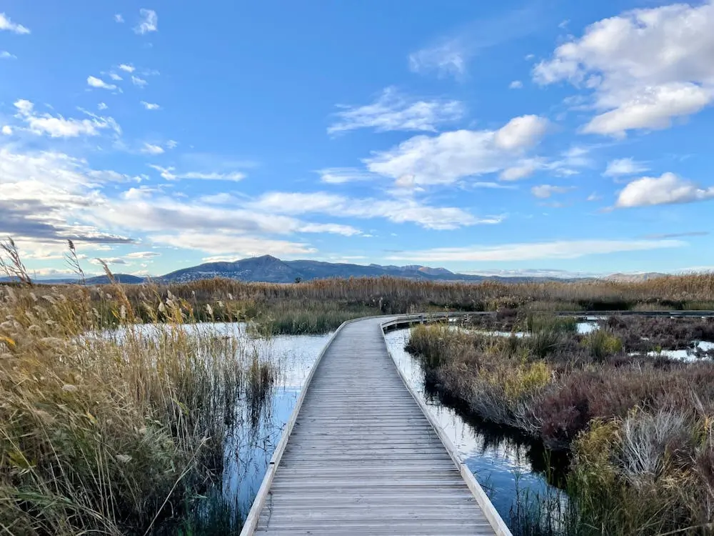
Day 6-7: Valencia Region Entry – Almansa to Xàtiva
Almansa, though a modest town today, held strategic importance in Roman times due to its position along the Via Augusta near the border of Contestania and Carthaginensis.
Known in antiquity as a minor stopover rather than a major city, it likely served as a mansio (an official rest station for travelers, couriers, and military convoys). Archaeological evidence is limited but includes Roman road segments and scattered villa remains in the surrounding countryside.
Distance from Jaén: 280 km to Almansa
Roman Heritage at Almansa
- Villa Romana del Potrero: 4th century villa with geometric mosaics
- Via Augusta stone markers: Milestone XVII preserved in town center
Walking Section – Almansa
Walk from Plaza de Santa María to Calle las Norias where Villa Romana foundations are visible, continue to milestone marker on Avenida José Rodríguez Ruano. Distance: 1.8 km, 30 minutes
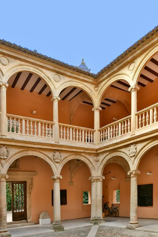
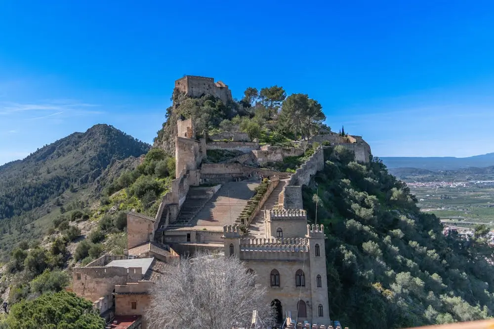
Xàtiva (Saetabis)
Xàtiva is a medieval town built on Roman foundations. Known to the Romans as Saetabis, it was a well-established Roman municipium in the province of Hispania Tarraconensis. Renowned for its high-quality linen production, Saetabis was mentioned by classical authors like Pliny the Elder.
The city featured typical Roman infrastructure, including baths, forums, and a theater, much of which remains buried beneath the modern town but has been partially uncovered through archaeological digs.
Roman Heritage at Xàtiva
- Xàtiva Archaeological Museum: Roman fibulae, coins from Saetabis mint
- Via Augusta urban section: Roman road stones visible on Carrer Acadèmia
Walking Section – Xàtiva
From the train station, walk along the former Via Augusta route via Carrer Xàtiva to Plaza del Mercado, continue uphill to the castle where Roman foundations exist. Distance: 2.5 km, 45 minutes
Day 8-9: Sagunto (Saguntum) – Major Roman Site
Distance from Xàtiva: 60 km via A-7 coastal route or even faster with RENFE Cercanías C-5 train.
Sagunto, known as Saguntum in Roman times, was a prominent Iberian settlement that gained lasting fame after resisting Hannibal’s siege in 219 BCE, a pivotal event that sparked the Second Punic War.
Following its destruction and subsequent Roman reconstruction, Saguntum became a thriving Roman municipium. Its well-preserved Roman theater, built into the hillside in the 1st century CE, remains a centerpiece of the city’s heritage.
Roman Heritage
- Roman Theatre of Sagunto: 1st century AD theatre, restored cavea and scaenae frons
- Sagunto Archaeological Museum: Roman glass collection, inscribed altars to Jupiter
- Roman Circus remains: Spina foundations visible near Calle del Circo Romano
- Via Augusta paving: Original Roman stones on Calle Castillo
- Roman walls: Opus quadratum blocks in castle fortifications
- Domus dels Peixos: Roman house with fish mosaics, nymphaeum
Walking Section
Start at the Roman Theatre, walk up Via del Castell following the Via Augusta route through the old town, visit Domus dels Peixos, continue to the castle, seeing Roman wall sections, descend via Calle Mayor to Circus remains. Distance: 3.5 km, 2 hours
Day 10-11: Valencia (Valentia)
Distance from Sagunto: 25 km, 20 minutes from Sagunto via A-7 or just 15 minutes by RENFE Cercanías C-5 or C-6 lines.

Of course, Valencia itself and its outskirts can take a week or two with the plethora of different cultural, historic, and entertainment sites. But this itinerary focuses on Roman history alone.
Valencia, originally founded as Valentia Edetanorum in 138 BCE, began as a Roman military colony for veterans of the Lusitanian campaigns. Strategically located near the mouth of the Turia River, it developed quickly into a structured Roman town with a grid layout, forum, baths, and temples.
While much of ancient Valentia lies beneath the modern city, key sites remain accessible, most notably the L’Almoina Archaeological Centre, where visitors can view foundations of streets, houses, and the city’s original forum. Roman ceramics, coins, and mosaics found here illustrate Valentia’s role as a functioning urban center in the Roman province of Hispania Tarraconensis.
Roman Heritage of Valencia
- L’Almoina Archaeological Center: Roman forum paving, 1st century thermal baths, horrea warehouses
- Valencia History Museum: Roman milestone from Via Augusta, amphora collection
- Via Augusta urban route: Roman road stones are visible beneath the Plaza de la Virgen
- Roman port remains: Quayside structures in L’Almoina excavation
Walking Section
Start at L’Almoina Archaeological Center, walk through Plaza de la Virgen where Via Augusta passed, continue along Calle Caballeros (ancient cardo maximus), finish at Valencia History Museum. Distance: 1.5 km, 30 minutes.
Day 12: Tarragona (Tarraco) – UNESCO World Heritage
Distance from Valencia: 350 km, 3.5 hours via AP-7 highway, a little short if taking RENFE Euromed train.
Tarragona, once known as Tarraco, was the capital of the Roman province of Hispania Citerior and later Hispania Tarraconensis, one of the most important Roman cities in the Iberian Peninsula. It served as a major political and military hub, visited by emperors such as Augustus, who made it his base during campaigns in Hispania.
Today, Tarraco’s Roman legacy is remarkably preserved: visitors can walk through its vast amphitheater overlooking the sea, explore the remains of the circus and forum, and view original Roman walls integrated into the modern city.
Roman Heritage (UNESCO Site)
- Roman Amphitheatre: 2nd century AD, marble seats, gladiator inscriptions
- Circus of Tarragona: 325m long circus, preserved spina and carceres
- Provincial Forum Complex: Temple of Augustus foundations, cryptoporticus
- Roman Walls: Megalithic blocks, 6 towers including Torre del Arquebisbe
- National Archaeological Museum of Tarragona: Medusa mosaic from Villa dels Munts, inscribed Via Augusta milestone
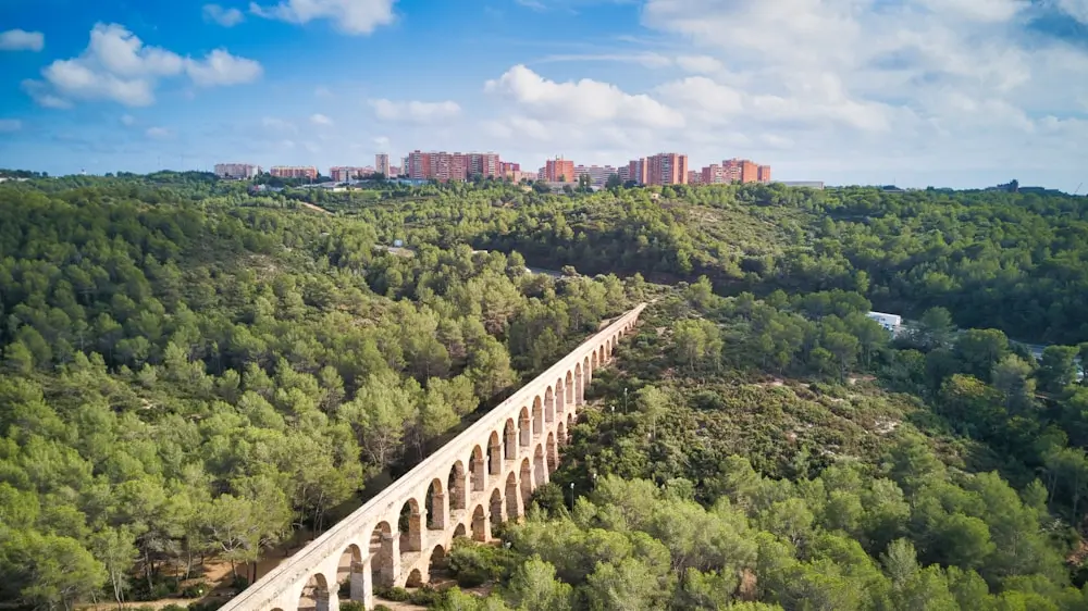
- Roman Aqueduct (Pont del Diable): 25 arches, 217m long, aqueduct to Tarraco
- Via Augusta milestone: Original milestone at Km 375 from Rome
- Early Christian Necropolis: Paleochristian sarcophagi, 3rd-7th centuries
Walking Section
Start at Amphitheatre, walk along Passeig Arqueològic following Roman walls, visit Provincial Forum area, continue to Cathedral (former Temple of Augustus site), walk down Carrer Major (Via Augusta route) to Circus, end at Archaeological Museum. Distance: 4 km, 2 hours 30 minutes
Day 13-14: Barcelona (Barcino)
Distance from Tarragona: 100 km, AP-7 or C-32 coastal road, though a bit longer, the coastal road has better views.
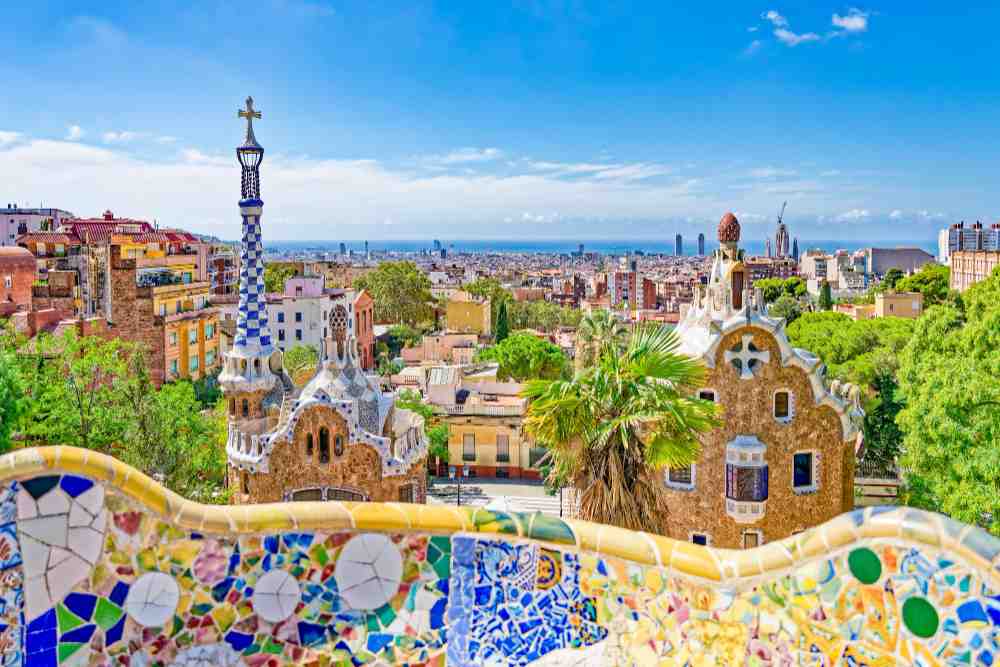
Barcelona, known in Roman times as Barcino, offers one of the clearest examples of how Roman foundations shaped a modern city. Though now a global cultural capital, its layout still reflects its origins as a Roman colonia established under Augustus.
The core of the Gothic Quarter follows Barcino’s original grid, and remnants of its forum, temple columns, and defensive walls are still visible among the medieval streets. Compared to monumental sites like Tarraco or Saguntum, Barcino was modest in size but well-organized, serving as a vital link along the Via Augusta.
Today, the Museu d’Història de Barcelona (MUHBA) allows visitors to walk through an excavated section of the Roman city, including laundries, houses, and streets, beneath the Plaça del Rei. This urban layering makes Barcelona a place where Roman heritage isn’t isolated to a few ruins, but built directly into the living fabric of the city.
Roman Heritage
- Barcelona City History Museum (MUHBA): 4th century Christian basilica, Roman garum factory, wine storage dolia
- Roman walls and towers: Torre de Sant Pau, Torre dels Soldats with original opus caementicium
- Temple of Augustus: Four Corinthian columns, 1st century BC-AD
- Roman necropolis: Via Sepulcral Romana with 85 tombs, funerary inscriptions
- Via Augusta urban section: Roman paving stones beneath Carrer del Bisbe
Walking Section
Start at MUHBA Plaça del Rei entrance, walk through Gothic Quarter following Via Augusta route along Carrer del Bisbe, visit Temple of Augustus, continue along Roman wall sections via Carrer del Sotstinent Navarro, end at Via Sepulcral Romana (Plaça Vila de Madrid). Distance: 2.8 km, 1 hour 15 minutes
Day 15: La Jonquera/Coll de Panissars – End Point
Distance from Barcelona: 150 km, approximately 1.5 hours on the AP-7 highway to the French border. No train options available here, but the highway follows the exact Roman route.
At the northeastern edge of Catalonia, near the modern town of La Jonquera, the Via Augusta reaches its final point at Coll de Panissars, where the Roman road once crossed the Pyrenees into Gaul. This mountain pass served not only as a physical gateway between Hispania and the rest of the empire, but also as a symbolic endpoint to one of Rome’s longest roads.
The remains of a Roman triumphal monument, built by Pompey in the 1st century BCE to commemorate his campaigns, still stand here in partial ruin. Unlike the urban remains of Barcino or Tarraco, this site offers a more rugged, frontier atmosphere. Today, the site sits just above the modern highway, quietly marking the transition between empires, eras, and territories.
Roman Heritage
- Coll de Panissars: Original Via Augusta mountain pass
- Roman road remains: Visible ancient paving stones
- Pertús Pass: Historic crossing point to Gaul
- Border milestone: Marking the end of Via Augusta
- Archaeological sites: Roman way stations and fortifications
Via Augusta Route Highlights
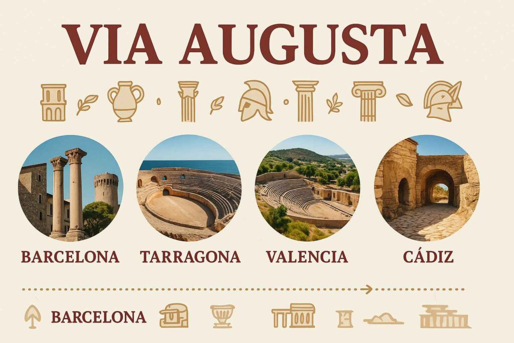
As mentioned before, the Via Augusta was the longest Roman road in Hispania, stretching from the Pyrenees to Cádiz. More than a trade route, it linked cities, military outposts, and colonies, shaping the urban and economic landscape of the Iberian Peninsula.
Along its path, travelers encountered the port city of Gades, the intellectual center of Corduba, and the administrative heart of Tarraco. Even in smaller stops like Saetabis or Aurgi, Roman influence left lasting marks.
Roman Engineering Features along Via Augusta
- Milestones: Original distance markers throughout route
- Roman bridges: Especially Córdoba and various river crossings
- Road construction: Visible Roman paving techniques
- Mountain passes: Engineering solutions in Pyrenees approach
Archaeological sites along the way
- Road width: Standard Roman 14-foot width where preserved
- Construction layers: Roman foundation techniques are still visible
- Drainage systems: Roman engineering for water management
- Way stations: Mansiones and mutationes ruins along the route
Pin this for later


Comments