
Britain has plenty of historic road trips. This one is different. Watling Street has been carrying travelers for nearly two thousand years, and long stretches of it are still your route today, running beneath the A2 and A5. You’re not following the Romans. You’re driving on them.
- What Watling Street Is and Why It Still Matters
- How the Antonine Itinerary mapped the route in the 2nd century
- Where Watling Street survives in today’s A2 and A5
- Dover, Kent: Where the Journey Begins
- Dover’s Painted House: the best-preserved Roman interior in northern Europe
- Dover Castle and the Roman lighthouse inside it
- Richborough: the detour worth making before Canterbury
- Canterbury: Roman Capital Beneath a Cathedral City
- The Roman Museum Canterbury and its in-situ mosaic floor
- Rochester: The Medway Crossing That Kept the Army Moving
- The Roman bridge site and what Rochester Castle replaced
- Reading Rochester’s Roman past through its medieval street plan
- London: Londinium, the Provincial Capital and Road Hub
- The London Mithraeum at Bloomberg SPACE, a temple preserved in place
- Walking the Roman wall circuit through the City of London
- Tip
- Brockley Hill: The Pottery Works Between London and St. Albans
- What the Brockley Hill kilns produced and who used them
- St. Albans: The Best Roman Site Most Americans Have Never Heard Of
- Tip
- Verulamium Museum: mosaic floors, painted plaster, and the iron-age to Roman transition
- The Roman Theatre of Verulamium, Britain’s only visible Roman stage theatre
- The hypocaust and city wall walk at Verulamium Park
- Fenny Stratford: A Roman Posting House Now Under Milton Keynes
- What survives of Magiovinium and where to find it
- Towcester: A Roman Market Town Still Following Its Ancient Street Plan
- Roman Towcester: the street plan, earthworks, and Watling Street pub
- Tip
- Whilton Lodge: The Unexcavated Station Linked to St. Patrick
- The St. Patrick connection at Bannaventa: what the evidence actually says
- Wroxeter: The Fourth-Largest Roman City in Britain, Still Standing
- Wroxeter’s Old Work and bathhouse: what you’re actually looking at
- What English Heritage manages at Wroxeter Roman City today
- Driving the Watling Street Route: A 7-Day Itinerary from Dover to Wroxeter
- Days 1 and 2: Dover to London
- Days 3 and 4: London to St. Albans and Towcester
- Days 5 to 7: Towcester to Wroxeter
- Tip
- Read more
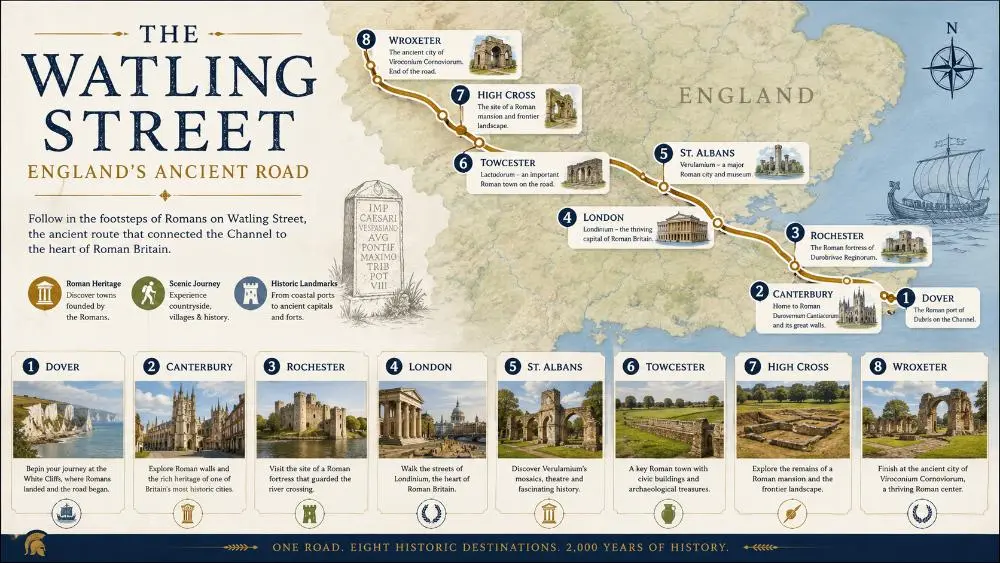
The road ran from Dover on the Kent coast to the legionary fortress at Wroxeter, near the Welsh border, covering well over 150 miles. Along the way, it passed through Canterbury, London, St. Albans, and a string of smaller posting stations that kept the empire moving. This itinerary covers all of them, with enough context to make the ruins actually make sense.
What Watling Street Is and Why It Still Matters
Watling Street wasn’t one project. It grew with Roman Britain, extended as the army pushed northwest, and administrators needed a reliable supply line from the Channel ports to the frontier. By the 2nd century AD it had become the spine of the province, the road every governor, merchant, and courier used.
The name itself is Anglo-Saxon, not Roman. The Saxons inherited the road and kept using it, calling it Waeclinga Straet. Medieval pilgrims walked sections of it to Canterbury. Chaucer’s pilgrims followed parts of it. Even the current A2 and A5, which millions of drivers use every week, trace the same alignments the Roman surveyors laid out with a groma and a theodolite equivalent nearly two millennia ago.
How the Antonine Itinerary mapped the route in the 2nd century
The Antonine Itinerary is a 3rd-century Roman document listing routes, stations, and distances across the empire. Iter II, the second route in the British section, names Richborough (Portus Ritupis) as the southeastern terminus, but Dover (Dubris) was the primary cross-Channel port for most of the Roman period and the practical starting point for anyone arriving from Gaul.
| Roman name | Modern location | Role on the route |
|---|---|---|
| Dubris | Dover, Kent | Primary cross-Channel port |
| Durovernum Cantiacorum | Canterbury | Regional administrative capital |
| Durobrivae | Rochester | Medway river crossing |
| Londinium | London | Provincial capital and road hub |
| Verulamium | St. Albans | Major civitas capital |
| Lactodurum | Towcester | Strategic midpoint station |
| Viroconium Cornoviorum | Wroxeter | Legionary fortress and frontier town |
Both ports fed into Canterbury, and from there the road ran as a single continuous artery northwest to Wroxeter and beyond to Hadrian’s Wall, a corridor of roughly 500 Roman miles. (Source: Itinerarium Antonini Augusti, Iter II, c. 3rd century AD)
The itinerary names each station with its Roman mileage from the previous stop, which is why modern archaeologists can cross-reference it with known geography to pinpoint sites like Bannaventa or Magiovinium with reasonable accuracy. It’s the closest thing Roman Britain left to a road atlas.
Where Watling Street survives in today’s A2 and A5
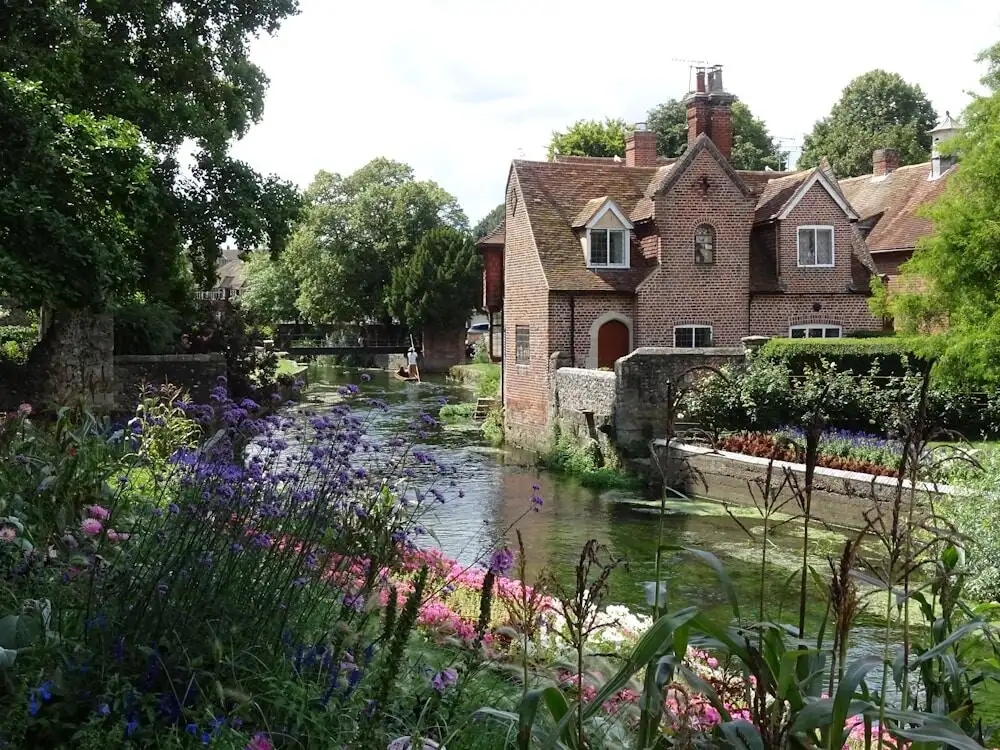
The A2 follows the Roman line from London through Rochester to Canterbury and down to the coast. The A5 picks it up northwest of London, running through St. Albans, Towcester, and onward toward Wroxeter. In some stretches the modern road sits directly on the Roman agger, the raised gravel bank the legions constructed. In others, you’re running parallel within a field’s width of the original.
The straightness gives it away. Drive the A5 north of St. Albans and the road barely curves for miles. Roman surveyors prioritized speed over topography whenever the terrain allowed, and that geometry is still visible from the air and felt on the ground. Multiple sections of Watling Street are recorded as Scheduled Ancient Monuments on the Historic England National Heritage List.
Dover, Kent: Where the Journey Begins
Dubris was Rome’s principal naval base in Britain, home to the Classis Britannica, the Channel fleet responsible for supply lines, troop movements, and cross-Channel communications throughout the occupation. The modern Port of Dover sits almost exactly where Roman ships docked, which means that if you arrive in Britain by ferry today, you’re following the same route Roman travelers used for nearly four centuries.
Dover has two significant Roman structures still standing, which makes it a stronger opening to the road trip than many visitors expect.
Dover’s Painted House: the best-preserved Roman interior in northern Europe
The Roman Painted House, discovered during construction work in 1970, preserves the largest area of in-situ Roman wall painting north of the Alps. The paintings decorated a mansio, an official guest house, and their colors, deep reds, greens, and architectural trompe l’oeil panels, have survived because the building was deliberately backfilled in the 3rd century to support new construction. You’re seeing them essentially as a Roman traveler would have, at eye level, in context.
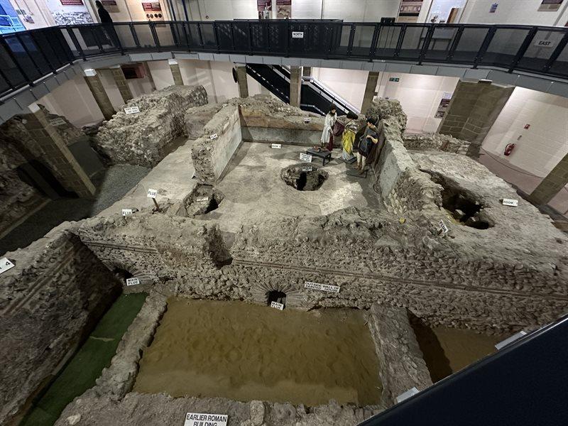
The site is managed by the Dover Roman Painted House Trust and is open to visitors seasonally. Allow an hour. It’s a small site but the quality of the painting is genuinely exceptional.
Dover Castle and the Roman lighthouse inside it
Dover Castle contains one of the best-preserved Roman lighthouses in the world. The Pharos, built in the 2nd century AD to guide ships across the Channel, stands to nearly 19 meters, much of it original Roman masonry with the distinctive tile bonding courses that appear at Roman sites all along this route.
A second Pharos stands within the castle grounds in a more ruined state. English Heritage manages the castle, and the lighthouse is included in general admission.
Richborough: the detour worth making before Canterbury
Richborough (Portus Ritupis), about 15 miles north of Dover near Sandwich, was the formal ceremonial gateway to Roman Britain rather than its main working port.
A massive triumphal arch once stood here, roughly 25 meters high and clad in imported Italian marble, marking the official entrance to the province. Its cross-shaped concrete foundations are still visible at the center of the site.
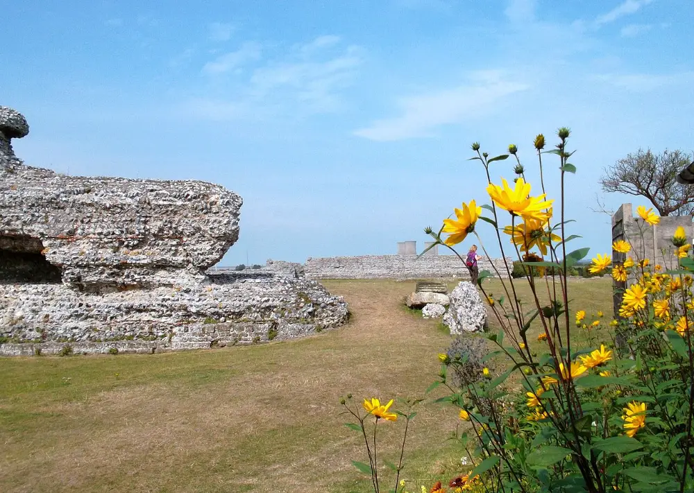
The late Roman fort walls are substantial and walkable, and a small English Heritage museum holds samian ware pottery, coins, and personal objects from the excavations. It’s mostly earthworks rather than standing structures, so the audio guide is essential for reading the landscape.
If you’re traveling with anyone who finds Roman history genuinely compelling, add two hours and go. If you’re working to a tight schedule, Dover and Canterbury cover the southeastern leg well on their own.
Canterbury: Roman Capital Beneath a Cathedral City
Canterbury draws millions of visitors every year for its cathedral, its medieval lanes, and its Chaucer connections. Most of them walk straight over the Roman city. Durovernum Cantiacorum was the administrative capital of the Cantii tribe, a major hub on Watling Street, and a city substantial enough to have its own theatre and a dense grid of streets that influenced Canterbury’s layout for the next fifteen centuries.
The Roman layers are literally below your feet in much of the city center. Several are accessible.
The Roman Museum Canterbury and its in-situ mosaic floor
The Roman Museum Canterbury is built around an excavated Roman townhouse, preserved in place after being uncovered during post-war rebuilding. The centerpiece is a geometric mosaic floor that has never been moved. You walk down into the excavation level and stand next to it, which puts you at the actual ground level of Roman Canterbury, about ten feet below the modern street.
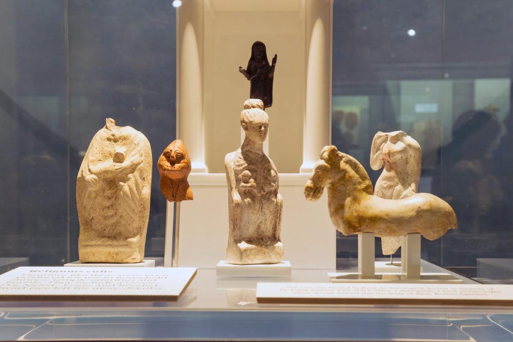
The museum holds a good range of objects from Canterbury’s Roman phases: painted wall plaster, bronze fittings, glassware, and pottery. The reconstructed Roman market scene is aimed at families but gives everyone a useful mental image of what a busy civitas capital actually looked like.
Rochester: The Medway Crossing That Kept the Army Moving
Durobrivae sat at one of the most strategically critical points on Watling Street: the River Medway. Without a reliable crossing here, the road was useless as a military supply route. The Romans bridged it early in the occupation and maintained that crossing for centuries. Rochester grew up around the bridge point and has never stopped being a crossing town.
The Roman city lies mostly under modern Rochester, but the logic of the place, a river town at a narrow crossing with commanding high ground above, explains every subsequent phase of its history, including the Norman castle that dominates the skyline today.
The Roman bridge site and what Rochester Castle replaced
The Roman bridge crossed the Medway slightly downstream from the current road bridge. Its timber piles were discovered during Victorian engineering works in the river, and more recent investigations have confirmed the alignment. Rochester Castle, built by the Normans in the 11th century, sits on the high ground that the Romans also fortified, so the strategic continuity here is direct and unbroken.
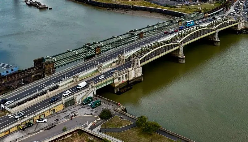
The castle itself is worth an hour, partly for the views across the Medway and partly because English Heritage has done a good job of presenting the full sequence of occupation from Roman through Norman to medieval.
Reading Rochester’s Roman past through its medieval street plan
Rochester’s Roman street grid is less visible than Canterbury’s, but the High Street essentially follows the Roman via principalis through the center of the town. The cathedral stands on or near the site of an earlier Roman public building, a pattern you’ll notice repeating at every major station along this route.
Rochester makes a good lunch stop rather than a half-day destination. The High Street has decent options, and the walk from the castle to the cathedral and back to the main road covers the most historically layered ground in about ninety minutes.
London: Londinium, the Provincial Capital and Road Hub
Londinium was not Rome’s first choice for a capital. That was Colchester. But London’s position at the tidal limit of the Thames, at the point where the river could be bridged but ships could still reach, made it economically dominant within a generation of the invasion. By the 2nd century, it was the largest city in Roman Britain, with a forum bigger than any other in the province, a governor’s palace, a port, and a circuit of walls enclosing some 330 acres.
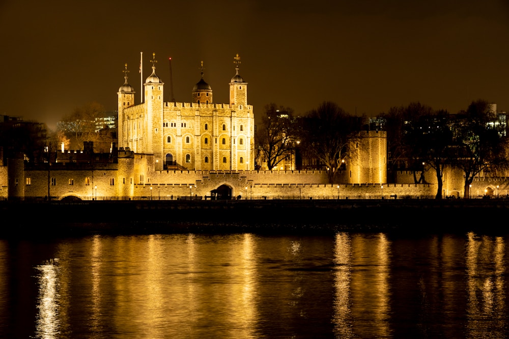
Fragments of all of this survive. London buries its history under centuries of continuous occupation, but it doesn’t erase it, and three sites in particular are worth your time.
The London Mithraeum at Bloomberg SPACE, a temple preserved in place
The Temple of Mithras was discovered in 1954 during construction work near the current Bloomberg European headquarters. After decades in a compromised location, Bloomberg funded a full relocation and preservation project that reunited the temple with its original ground level.
You can now visit it for free in the basement of the Bloomberg building, standing at the actual Roman floor level, with atmospheric sound and lighting that recreates something of what it would have felt like to be initiated into the cult. More than 600 Roman objects found at the Bloomberg site are displayed alongside the temple. It’s one of the best Roman visitor experiences in Europe, and almost no one outside London knows it exists.
Walking the Roman wall circuit through the City of London
London’s Roman wall, built in the late 2nd or early 3rd century, enclosed the city on three sides. Large sections survive, most of them built into or absorbed by later medieval and post-medieval structures. The best-preserved stretch runs through the garden at Tower Hill, where you can see Roman work clearly distinguished from medieval rebuilding by the tile bonding courses.
A self-guided wall walk covering the major surviving sections takes about two hours and connects Tower Hill, the Barbican, and several points in between. The Museum of London has free printed guides, or you can download a route from the City of London’s heritage pages.
Tip
London’s Roman layers are typically 15 to 20 feet below street level. Every major construction project in the City still triggers archaeological monitoring, which is why new finds keep appearing.
The Museum of London has consolidated much of its Roman collection at the Docklands site, where galleries cover Londinium’s port, its trade networks, and daily life in the city. The scale model of Roman London is a useful orientation before visiting any of the wall sections or the Mithraeum.
Brockley Hill: The Pottery Works Between London and St. Albans
Sulloniacae at Brockley Hill doesn’t appear in most travel guides. That’s partly because there’s no standing structure to photograph and partly because it sits in a suburban stretch of north London that doesn’t feel like a heritage destination. But if you’re following Watling Street seriously, it’s worth a stop.
This was one of the most productive pottery manufacturing centers in Roman Britain, supplying mortaria (mixing bowls) and other ceramic goods to London, to military sites, and to towns along Watling Street itself. The kilns operated from roughly the mid-1st century to the late 2nd century AD.
What the Brockley Hill kilns produced and who used them
Mortaria were essential kitchen equipment in Roman households, heavy ceramic bowls with a gritty inner surface used for grinding and mixing food. Brockley Hill mortaria have been identified at sites across Roman Britain, stamped with potters’ names that recur in the archaeological record at locations hundreds of miles apart.
It’s a tangible reminder that the road wasn’t just a military artery. It was a commercial network. Individuals find records from the Watling Street corridor, including pottery stamps and coins, are searchable through the Portable Antiquities Scheme, the British Museum’s national database of archaeological finds reported by members of the public.
Some kiln earthworks are visible on Brockley Hill itself, near the modern road. It’s not a managed heritage site, so visits are informal. The finds are held partly in the Museum of London and partly in the Edgware and District Archaeological Society’s collection.
St. Albans: The Best Roman Site Most Americans Have Never Heard Of
Verulamium is the reason to drive this route. It was the third-largest Roman city in Britain after London and Colchester, a civitas capital with its own forum, basilica, temples, theatre, and a planned street grid covering over 200 acres.
Tip
Plan a full day here. Between the museum, the theatre, and the park walk, you will not run out of things to see.
Unlike most Roman British cities, significant portions of Verulamium have never been built over. They sit under Verulamium Park on the edge of modern St. Albans, accessible and in some cases visible above ground.
Verulamium Museum: mosaic floors, painted plaster, and the iron-age to Roman transition
The Verulamium Museum is exceptional by any standard. Two large mosaic floors are displayed in situ, meaning they’ve never been moved, and you view them from a low angle that gives a real sense of the rooms they decorated. The painted wall plaster collection is one of the best in Britain, reconstructed into panels that show you what a Roman interior actually looked like.
The pre-Roman galleries cover the late Iron Age settlement that preceded Verulamium, including the Catuvellauni tribal oppidum that the Romans absorbed and rebuilt. Understanding that sequence makes the Roman city feel less like an imposition and more like a transformation.
The Roman Theatre of Verulamium, Britain’s only visible Roman stage theatre
Most Roman theatres in Britain were amphitheatres used for gladiatorial games. The theatre at Verulamium was a different kind of structure, a stage theatre used for drama, civic ceremonies, and religious performances, with a curved seating bank facing a raised stage. It’s the only example of this type visible anywhere in Britain.
The theatre sits adjacent to the museum, managed separately by the Verulamium Excavation Committee. The seating bank is partially reconstructed to give a sense of scale, and the stage area, orchestra, and dressing room foundations are all readable. It held roughly 6,000 people at its peak.
The hypocaust and city wall walk at Verulamium Park
A short walk from the museum, a sheltered structure in Verulamium Park protects an in-situ hypocaust: the underfloor heating system of a Roman townhouse. You can see the pilae stacks, the small brick columns that supported the floor and allowed hot air to circulate below it. It’s modest in scale but oddly moving, because it’s so domestic. Someone’s house. Someone’s heating system.
| Verulamium Museum | In-situ mosaics, wall plaster, Iron Age to Roman galleries |
| Roman Theatre | Only visible Roman stage theatre in Britain, seats 6,000 |
| Hypocaust | In-situ underfloor heating system, sheltered in Verulamium Park |
| City walls | Partial standing section near London Gate |
| Recommended time | Full day |
The city walls ran for nearly two miles around Verulamium. A substantial section survives as a landscaped earthwork in the park, and one section of the Roman flint wall is still standing to several meters in height near the London Gate. The park walk connecting these points takes about forty-five minutes at a leisurely pace.
Fenny Stratford: A Roman Posting House Now Under Milton Keynes
Magiovinium at Fenny Stratford is the most compromised site on the route. Milton Keynes absorbed the area in the 1960s and 1970s, and most of the Roman settlement is now under modern development. But it’s worth a brief stop for one specific reason: you can still read the landscape.
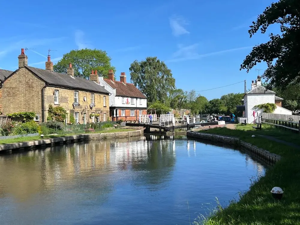
Posting houses (mansiones) were the Roman equivalent of a motorway service station combined with an official government hotel. Magistrates, soldiers, and imperial couriers could change horses, eat, and sleep at mansiones along all major roads. Magiovinium was one such station, positioned roughly halfway between Verulamium and the next major station at Towcester.
What survives of Magiovinium and where to find it
Some earthwork traces of Magiovinium are visible in the Fenny Stratford area, along the line of the A5 through Bletchley. The finds from archaeological investigations here, pottery, coins, and structural evidence, are held in the Milton Keynes Museum. The museum itself is worth a visit if you have time; it has a broader local history collection that contextualizes the Roman material.
This is a twenty-minute stop at most. Walk the A5 verge near the old Fenny Stratford bridge, note where the road alignment hasn’t changed in two thousand years, and move on.
Towcester: A Roman Market Town Still Following Its Ancient Street Plan
Lactodurum is now Towcester, a quiet Northamptonshire market town that most people pass through on the A5 without stopping. They’re missing something. The modern town center follows the Roman grid closely enough that walking Towcester’s main street is genuinely an experience of walking a Roman street line. The scale, the relationship between the main axis and the side streets, the position of the market area: all of it maps onto the Roman plan.
Towcester is also where the A5 makes one of its most dramatic straight runs. North and south of town, the road arrow-lines across open countryside with barely a curve.
Roman Towcester: the street plan, earthworks, and Watling Street pub
The Roman earthworks at Towcester are best seen at the south end of town, where the defensive bank and ditch are still visible as a low ridge. Archaeological investigations have found evidence of a substantial settlement here: a mansio, a market area, and several phases of occupation spanning the full Roman period.
The Watling Street pub on the main road is not just a good name. It’s a useful landmark for locating the core of the Roman settlement. The town museum, currently housed in the Old Tithe Barn, has a small but well-presented Roman collection including pottery, brooches, and coins from local excavations.
Tip
Towcester makes a logical overnight stop between the London section and the Wroxeter leg. The town has several good pubs with rooms, and it puts you well-placed for an early start to Whilton Lodge and beyond.
The countryside around Towcester rewards a short detour. The Northamptonshire hills roll away from the A5 in both directions, and the landscape has changed less here than almost anywhere else on the route. Daylesford, a few miles west, is known for its organic farm shop, a good stop for picnic supplies if you’re planning to eat at Verulamium Park or Wroxeter.
Whilton Lodge: The Unexcavated Station Linked to St. Patrick
Bannaventa near Whilton Lodge is the most speculative stop on the route and arguably the most intriguing. The site has never been fully excavated. What’s known comes from surface finds, limited investigations, and the Antonine Itinerary entry confirming a station here between Towcester and Wroxeter.
The St. Patrick connection is what gives it its particular atmosphere. Some historians and hagiographers have proposed that Bannaventa was the birthplace of St. Patrick, placing his father’s estate in this part of Roman Britain. The evidence is circumstantial, but it’s not nothing.
The St. Patrick connection at Bannaventa: what the evidence actually says
Patrick’s own account in his Confessio states that he was born in a place called Bannavem Taburniae, which his father Calpornius owned as a decurion, a local Roman official. Several locations across Roman Britain have been proposed as candidates, including Bannaventa at Whilton Lodge. The linguistic match is close, and the social profile fits: a Roman official with property in a posting station town is exactly the kind of person who might be named in the Antonine Itinerary’s orbit.
No inscription, no burial, no confirmed structural evidence links Patrick directly to Whilton Lodge. But standing in a field that was a functioning Roman town in the early 5th century, roughly when Patrick was born, and considering the possibility: that’s the kind of moment this road trip generates at its best.
Wroxeter: The Fourth-Largest Roman City in Britain, Still Standing
Viroconium Cornoviorum is the road trip’s destination and its most spectacular Roman site. The fourth-largest Roman city in Britain began as a legionary fortress in the 1st century AD, housing the XIV Legion before it was transferred to the continent. The legion’s departure left a large, planned settlement that grew into a thriving civilian city over the next two centuries.
What makes Wroxeter exceptional is the Old Work: a section of the municipal baths’ exercise hall wall that stands two storeys high, the largest freestanding piece of Roman masonry in England outside Hadrian’s Wall. Nothing else on this route prepares you for it.
Wroxeter’s Old Work and bathhouse: what you’re actually looking at
The Old Work is the remnant of the south wall of the palaestra, the open exercise hall attached to the baths. The large central doorway you can see in the wall led from the exercise hall into the heated bathing rooms. The wall stands because it was incorporated into a later Anglo-Saxon building, which accidentally preserved it while everything around it was robbed for stone.
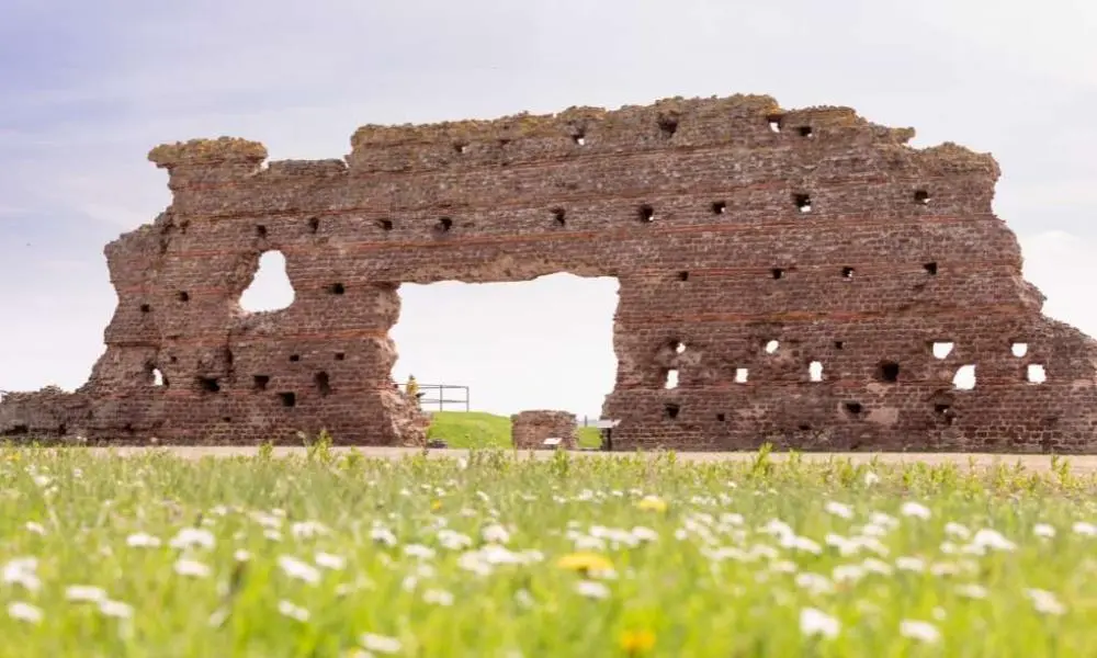
The bathhouse complex is laid out around the Old Work, with the changing rooms, cold bath, warm room, and hot room all readable in plan from the low foundation walls that survive. English Heritage’s audio guide at the site is excellent and takes you through the sequence of spaces in a way that makes a ruined bath complex feel completely coherent.
What English Heritage manages at Wroxeter Roman City today
English Heritage maintains the site with a visitor center, the on-site museum, and guided tours running in peak season. The museum holds the best finds from Wroxeter: a carved tombstone, ironwork, personal objects, and architectural fragments that give a sense of the city at its height in the 2nd century.
| Roman name | Viroconium Cornoviorum |
| Managed by | English Heritage |
| Key features | The Old Work, bathhouse complex, on-site museum |
| Recommended time | 3 hours minimum |
| Nearest town | Shrewsbury (5 miles) |
Allow at least three hours. The site is larger than it looks from the entrance, and the surrounding area, including the outline of the forum and the street grid readable as crop marks in the right light, rewards time spent simply walking and looking.
Driving the Watling Street Route: A 7-Day Itinerary from Dover to Wroxeter
Seven days gives you enough time to see the major sites properly without rushing and to absorb some of the smaller, less obvious stops that make the route more than a greatest hits tour. You’ll be driving primarily on the A2 and A5 for much of the route, with some detours onto minor roads for sites like Richborough and Wroxeter. A hire car from London is the most practical base if you’re flying in, or collect one at Dover if you’re crossing by ferry.
Days 1 and 2: Dover to London
Day 1 starts in Dover. Visit the Roman Painted House in the morning, then Dover Castle and the Pharos in the afternoon. If time and interest allow, drive the 15 miles north to Richborough before heading to Canterbury for the evening. The Roman Museum Canterbury is best visited late afternoon when school groups have left.
On Day 2, drive the A2 from Canterbury through Rochester. Spend an hour in Rochester, then continue into London following the A2 through Greenwich and into the city. Drop the car at your central London hotel: you won’t need it for the next two days. Use the London Mithraeum and the wall walk for Day 2 afternoon.
Days 3 and 4: London to St. Albans and Towcester
Day 3 is entirely St. Albans. Take the train from London St. Pancras to St. Albans City (20 minutes), which puts you directly beside Verulamium Park. The museum, theatre, and park walk fill a full day comfortably. Return to London for the night.
On Day 4, pick up the hire car again and drive the A5 northwest out of London, stopping briefly at Brockley Hill, then continuing to Fenny Stratford for a look at the Magiovinium area. Reach Towcester by late afternoon, check in, and spend the evening in the town.
Days 5 to 7: Towcester to Wroxeter
Day 5: Drive north from Towcester to Whilton Lodge for the Bannaventa stop, then continue on the A5 through Daventry. The landscape opens up here into classic English Midlands countryside.
Day 6: Continue northwest on the A5 through Cannock Chase and into Shropshire. The road becomes more rural and the Roman alignment increasingly dramatic in its straightness. Arrive at Wroxeter in the afternoon, check into accommodation in Shrewsbury, and return to the site fresh on Day 7.
Day 7: Give Wroxeter your full morning. Drive back to London via Shrewsbury and the M54/M6 corridor, allowing three to four hours depending on traffic. Return the hire car and fly home, or extend with a night in Shrewsbury, one of England’s best-preserved medieval towns.
Tip
The A5 between Towcester and Wroxeter is one of the straightest sustained road sections in Britain. On a clear day with low sun, the alignment ahead of you seems to go on forever. The Romans drove that line deliberately. It’s still worth feeling.
Not many road trips let you follow the same route for two thousand years. Watling Street does. You’re driving the same line that Roman couriers rode, that medieval pilgrims walked, that Anglo-Saxon traders used to move goods between Canterbury and the Welsh frontier. The road has changed in surface and speed, but the direction is the same.
The sites along it range from world-class, Verulamium and the London Mithraeum, to atmospheric earthworks that reward patient attention. What ties them together is the road itself, the sense of a continuous line of human movement running through the English landscape. If you’ve been looking for a road trip with genuine depth, this is it. Start at Dover and follow the Romans all the way to Wroxeter.
The 2nd-century Antonine Itinerary gives the course of Watling Street from “Urioconium” (Wroxeter) to “Portus Ritupis” (Richborough) as a part of its Second Route (Iter II) Watling Street – Wikishire, which formed part of a longer 501-mile route from Hadrian’s Wall to the Channel ports.
Main Stations (Southeast to Northwest):
- Portus Ritupis (Richborough) – Primary Roman landing port
- Durovernum Cantiacorum (Canterbury) – Regional administrative center
- Durobrivae (Rochester) – River Medway crossing point
- Londinium (London) – Provincial capital and Thames crossing
- Verulamium (St. Albans) – Major civitas capital
- Lactodurum (Towcester) – Strategic midway station
- Viroconium Cornoviorum (Wroxeter) – Legionary fortress and frontier town
Secondary Stations and Posting Houses:
- Noviomagus (Crayford) – Between Rochester and London
- Sulloniacae (Brockley Hill) – Between London and St. Albans
- Magiovinium (Fenny Stratford) – Between St. Albans and Towcester
- Bannaventa (Whilton Lodge) – Between Towcester and Wroxeter
The Roman Antonine Itinerary lists sites along the route of Watling Street as part of a longer route of 500 Roman miles connecting Richborough with Hadrian’s Wall via Wroxeter Watling Street | The Spectator, demonstrating its critical role as Britain’s primary arterial highway linking the Channel ports with the Welsh frontier and northern garrisons.