The mountains call to us in different languages, from the Welsh valleys of Snowdonia to the volcanic peaks of Indonesia. Here are the 10 easiest mount ascents for beginners. Each summit teaches unique lessons, whether it’s navigating through Scottish mist or watching sunrise paint the clouds gold from an Indonesian volcano. This carefully curated collection of ten international peaks offers aspiring mountaineers a passport to understanding how mountains shape cultures, challenge bodies, and expand minds across six continents.
- Mount Kosciuszko: Summit Walk via Thredbo
- Cradle Mountain
- Mount Snowdon: Llanberis Path
- Ben Nevis: Tourist Route
- Scafell Pike via Wasdale Head
- Table Mountain: Platteklip Gorge
- Pico do Arieiro, PR1
- Mount Monadnock: White Dot Trail
- Mount Batur
- Mount Pilatus
- Essential gear
- Training
- Skills Development
- Foundation Phase
- Weather Education
- Cultural Integration
- Technical Development
- Alpine Integration
- Useful links
Mount Kosciuszko: Summit Walk via Thredbo
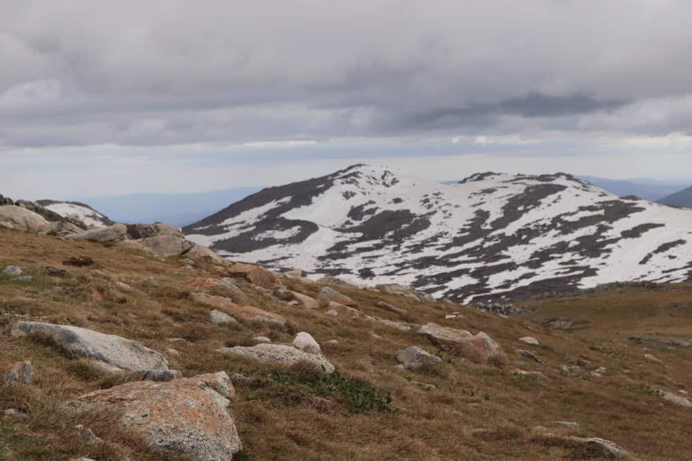
This route is ideal for those seeking a straightforward ascent to the summit of Mount Kosciuszko, providing panoramic views of the Snowy Mountains and the surrounding alpine landscape. Probably the easiest ascent on the list, yet the highest peak of Australia. The path is well-maintained with a gentle gradient, allowing one to enjoy the alpine wildflowers, herbs and snow gums.
Trek Details
Local Tips:
- Book chairlift tickets in advance during peak season
- Respect fragile alpine vegetation – stay on path
- Last chairlift typically runs late afternoon
- Combine with other Kosciuszko walks if time permits
Cradle Mountain
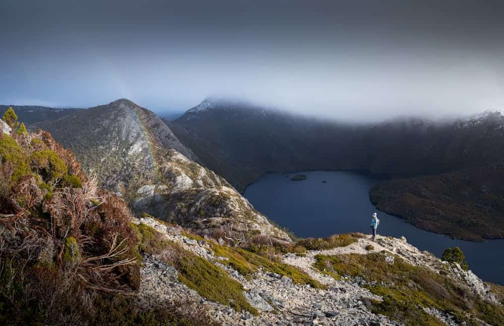
This climb blends alpine lakes, rainforest, and dolerite tors, culminating in a routed summit scramble. it starts on gentle boardwalk and gravel paths around Dove Lake and Crater Lake, easing walkers into alpine terrain without technical gear. The climb combines learning moments—like navigating dolerite boulders and fixed-chain sections, while allowing safe fallback to lower lookouts. Plus, early-stage views of Wombat Pool and Crater Lake extend motivation.
Trek Details
Mount Snowdon: Llanberis Path
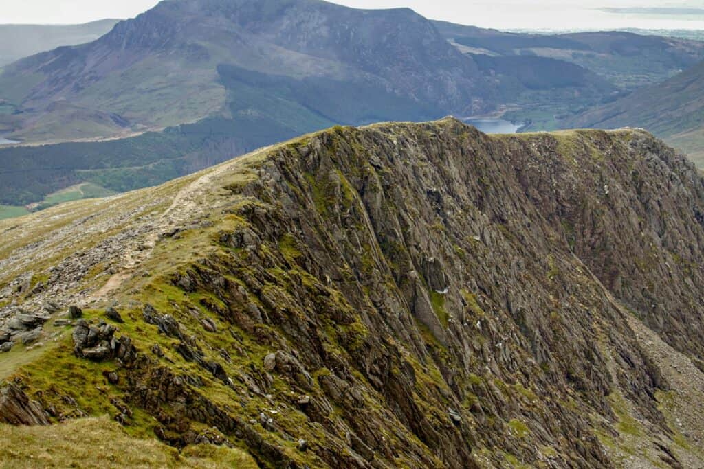
The Llanberis Path is ideal for first-time visitors and those seeking a less demanding ascent, offering scenic views and a steady climb to Wales’ highest peak. Thus, the Welsh place names on maps. The area is very popular and provides good infrastructure, there’s a visitor center and café at the summit. The crowds are possible, and the parking fills up quickly in summer.
Key Features:
- Historic Snowdon Mountain Railway runs parallel to the path
- Excellent introduction to British mountain weather
- Visitor center and (seasonal)
- Views over Snowdonia National Park
Trek Details
Ben Nevis: Tourist Route
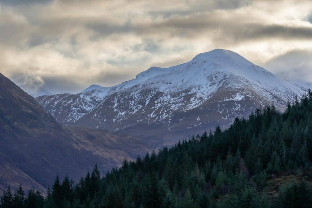
The Ben Nevis Mountain Track is suitable for hikers with good fitness levels who seek to summit the UK’s highest peak without technical climbing experience. The ‘tourist route’ name can be misleading; the ascent is not a stroll in the park. Temperatures can drop to freezing even in summer, while winds can exceed 100 mph, with snow possible all year round.
Trek Details
Key Features:
- UK’s highest peak
- Notorious for rapid weather changes
- Above tree line for most of route
- Memorial cairns and mountain rescue posts
- Views to Inner Hebrides on clear days
Scafell Pike via Wasdale Head
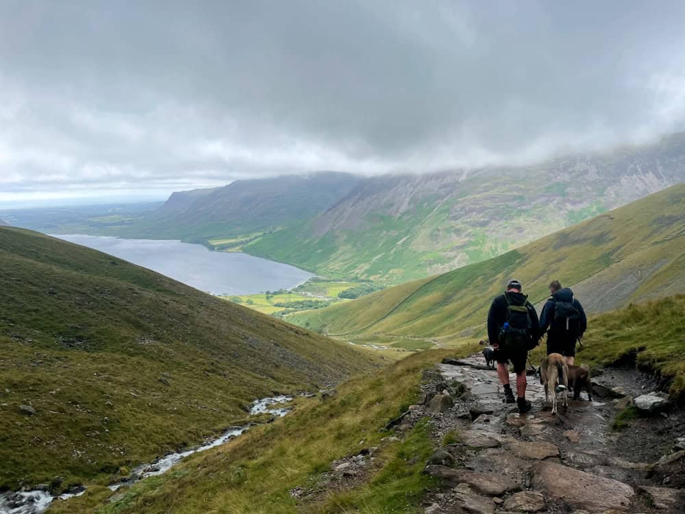
This route is renowned for its direct approach to Scafell Pike’s summit, offering hikers panoramic views of the Lake District. It is the highest peak in England, with a traditional English pub at the trailhead for a post-climb meal. The experience is a classic Lake District fell walking with the views over Wastwater (England’s deepest lake).
Trek Details
Even though the ascent is considered beginner-friendly, there are a few specific conditions to consider: strong southeasterly winds (“Cape Doctor”) and occasional cloud cover (“tablecloth”).
Local Tips:
- Start very early to avoid heat and crowds
- Carry ID for park entry
- Check cable car operating times
- Be aware of baboons – don’t feed them
- Consider a combination ticket for the cable car descent
Table Mountain: Platteklip Gorge
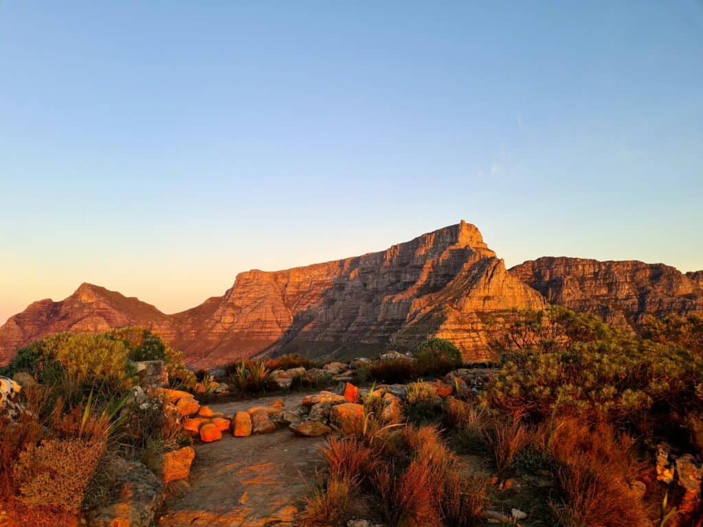
Platteklip Gorge is the most straightforward route to the summit of Table Mountain, making it a popular choice for hikers seeking a direct ascent. While the trail is physically demanding due to its steep incline, it does not require technical climbing skills. Hikers are rewarded with panoramic views of Cape Town and the surrounding areas upon reaching the summit.
Trek Details
Key Features:
- Iconic Cape Town landmark
- Steep, direct route up main face
- Spectacular 360-degree views from flat summit
- Cable car option for descent
- Unique fynbos vegetation
Pico do Arieiro, PR1
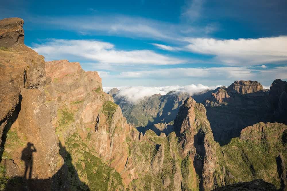
This trail is renowned for its breathtaking vistas and unique geological features, making it one of Madeira’s most iconic hikes. While challenging, it rewards hikers with unparalleled views and a sense of accomplishment upon reaching the island’s highest peak. The highlights of the path are hand-carved tunnels through the rock, featuring levada-style engineering
Trek Details
Mount Monadnock: White Dot Trail
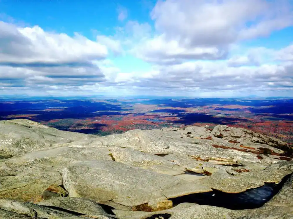
Mount Monadnock is renowned for its panoramic summit views and is one of the most frequently climbed mountains in the world, and the most climbed one in North America. The White Dot Trail offers a direct and rewarding ascent, making it a favorite among hikers seeking a challenging yet accessible hike.
Trek Details
Mount Batur
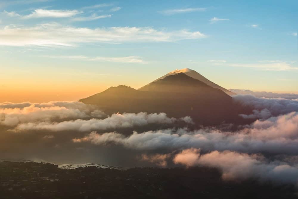
Mount Batur’s sunrise ascent is well-suited for first-time hikers due to its clear, well-trodden trail. Climbers are rewarded with the surreal experience of watching sunrise light up Lake Batur and neighboring volcanoes like Agung and Rinjani. However, this route sees 300–600 hikers per day, creating bottlenecks in steep zones and narrow ridge paths. The climate is tropical and humid, but summit on the sunrires can be surprisingly cold.
Trek Details
Key Features:
- Active volcano with recent eruptions
- Famous sunrise viewing destination
- Hot springs at base
- Views over Lake Batur caldera
- Traditional Balinese guide culture
Mount Pilatus
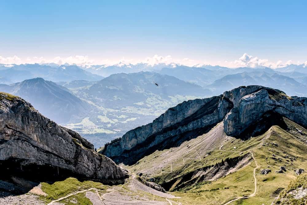
Mount Pilatus is located south of Lucerne and is accessed by the world’s steepest cogwheel railway, scaling a 48 % gradient over 4.6 km from Alpnachstad to the summit station at Esel/Oberhaupt. This ascent parallels the railway, weaving through forests, wildflower meadows, and scree slopes.
What separates Pilatus from other Swiss peaks is its layered approachability. Walkers can challenge themselves on routes like Alpnachstad or Fräkmüntegg–Kulm, and then enjoy engineered comforts like the Dragon Trail cave path or easy summit loops to spots like Oberhaupt and Tomlishorn.
Trek Details
Key Features:
- Classic Swiss Alpine experience
- Multiple access options (hiking, railway, cable car)
- Spectacular views over Lake Lucerne
- Historic cogwheel railway (world’s steepest)
Essential gear
Hypothermia is the biggest threat during any hike, especially due to rapid weather changes, particularly during nighttime or morning hours. So the most essential gear for any climate is waterproof layering. Reliable navigation tools and emergency communication devices are a must, even for short climbs, as well as UV protection
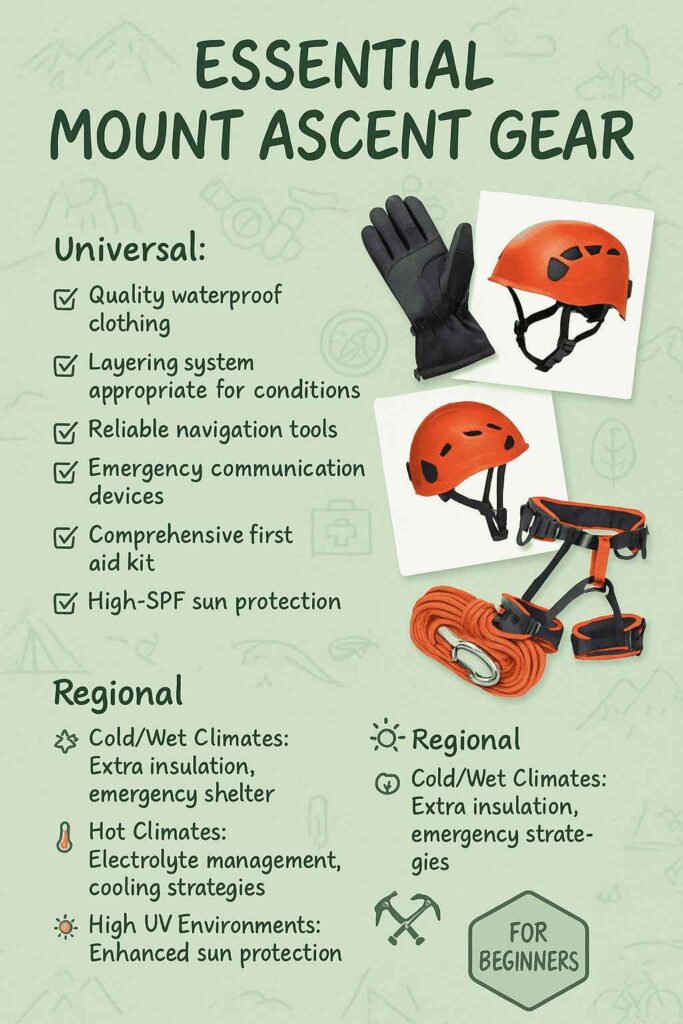
The regional essentials might differ depending on the climate, it could be electrolytes to prevent dehydration, dust protection, or extra insulation.
Training
| Physical Preparation | Skill Development | Mental Preparation |
|---|---|---|
| Cardiovascular Fitness: Running, cycling, stair climbing | Navigation Courses: Map, compass, and GPS training | Risk Assessment: Learning to make safety decisions |
| Strength Training: Focus on legs, core, and carrying capacity | First Aid Training: Wilderness-specific medical training | Discomfort Management: Dealing with challenging conditions |
| Specific Training: Hiking with weighted pack | Weather Interpretation: Understanding forecasts and signs | Cultural Awareness: Respecting international mountain cultures |
| Flexibility: Yoga or stretching for mobility | Local Knowledge: Research specific mountain conditions | Environmental Stewardship: Leave-no-trace principles globally |
Skills Development
Rather than treating each mountain as an isolated experience, this collection creates a comprehensive curriculum in international mountaineering. The progression from gentle walks to technical challenges mirrors how professional guides develop clients’ abilities over time.
Mountains are not conquered, but negotiated. Each peak teaches us something new about ourselves and our relationships with the natural world. The best mountaineers are students first, athletes second.
Reinhold Messner
Foundation Phase
Mount Kosciuszko and Cradle Mountain’s circuit provide confidence-building experiences in controlled environments. The chairlift access and well-maintained facilities allow focus on basic skills without overwhelming challenges.
Weather Education
British peaks deliver intensive courses in mountain meteorology. The rapid changes and challenging conditions create learning opportunities impossible to replicate elsewhere, while rescue infrastructure provides safety nets during the education process.
Cultural Integration
Bali and Madeira demonstrate how different cultures approach mountain relationships. Learning to work with local guides and understanding sacred site protocols provides essential skills for global mountaineering.
Technical Development
The scrambling sections on Monadnock, Scafell Pike, and Table Mountain build movement skills progressively. Each peak presents slightly more challenging terrain, allowing confidence to develop naturally.
Alpine Integration
Mount Pilatus demonstrates how modern mountaineering integrates traditional skills with contemporary infrastructure. Understanding these relationships proves crucial for planning future objectives in developed mountain regions.
The beauty of this progression lies not in checking boxes but in developing genuine mountain judgment. Each peak teaches lessons impossible to learn elsewhere, while the cumulative experience creates well-rounded mountaineers prepared for objectives far beyond these introductory summits.
Useful links
- IFMGA – International Federation of Mountain Guides Associations. The global organization for professional mountain guides, helping you find certified guides worldwide
- UIAA – International Climbing and Mountaineering Federation. Represents over 3,000,000 climbers and mountaineers from member federations on all six continents, with safety and training resources.
- UIMLA – Union of International Mountain Leader Associations. International governing body representing Mountain Leaders worldwide, setting equal standards of qualifications globally
- British Mountaineering Council (BMC). 80,000-strong community offering training courses, coaching workshops, and resources for climbers of all levels
- Mountain Training International Provides internationally recognized mountain leadership qualifications and training standards used worldwide
Pin this for later